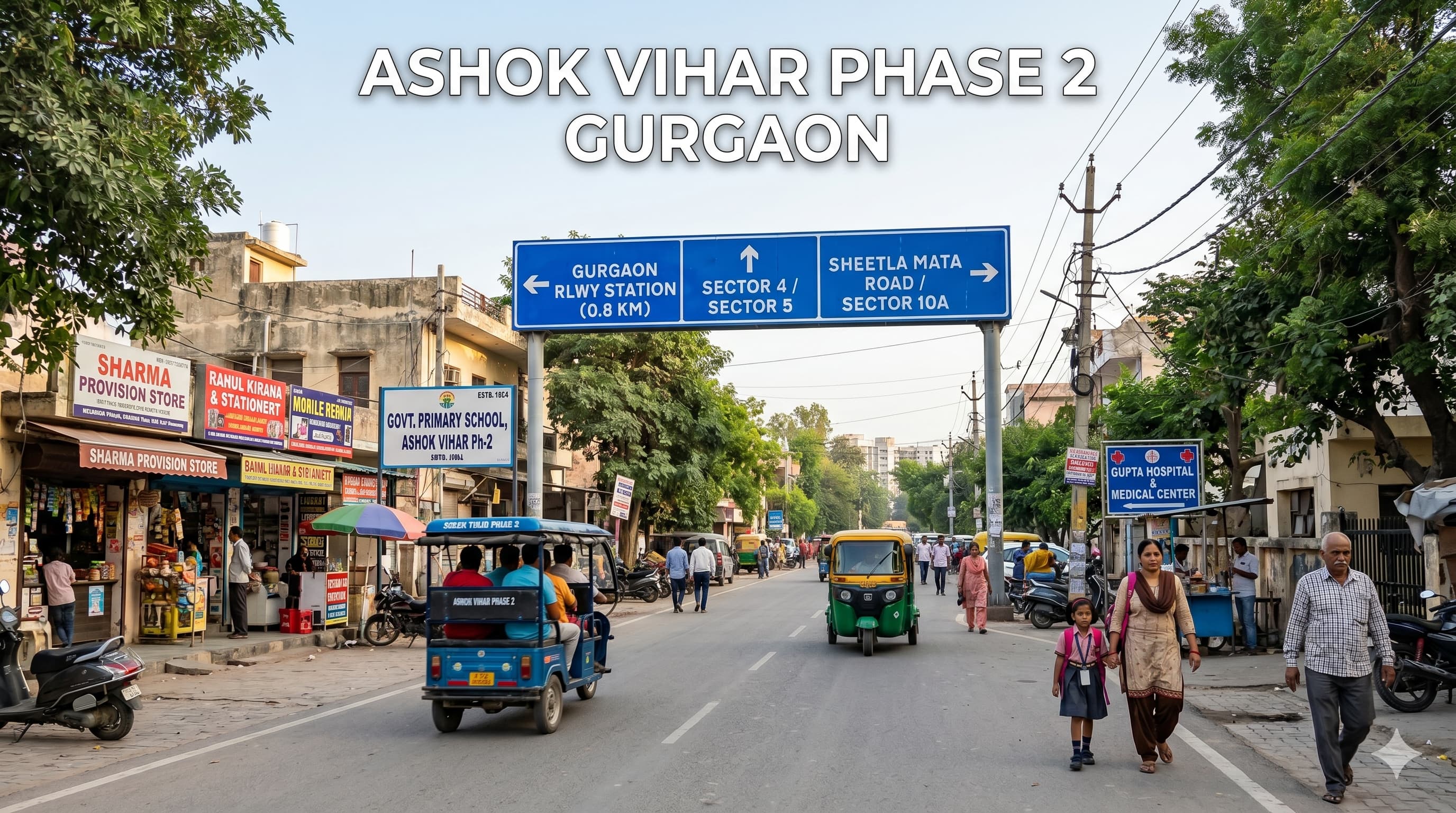
Ashok Vihar Phase 2 Gurgaon Introduction
Ashok Vihar Phase 2 Gurgaon is an area that I know well in the old Gurugram near Sector 3, Sector 4, Sector 5, Laxman Vihar, Sheetla Mata Road and near Gurgaon Railway Station side. One frequently searches for Ashok Vihar Phase 2 Gurgaon pin code as one needs to check for the correct details online as there are discrepancies regarding the same with some sources having it as 122001 whereas some have 122022 as the correct pin code. Hence, it would be better if you can cross verify before using it for delivery or any document work.
Most people look for details about this area in order to get clarity before visiting the place. They need information regarding how the area looks, connectivity of roads to it, the schools/hospitals nearby, public transport availability and things to consider prior to making any move.
The atmosphere of this area has the feel of the old Gurgaon. It is not very sophisticated, but quite functional. One comes across small local shops, everyday stores, small service centers, food joints, medical shops etc. There are people moving here and there on the nearby roads.
It would be best for someone visiting the area for the first time to approach things in an uncomplicated manner. It does not make sense for someone to form opinions based on just one street or photographs on the internet. Checking out the actual lane, its size, and ease of access to other areas from there will go a long way.
Local Area Snapshot for First-Time Visitors
This is a good place for local knowledge. The connection with the roads of Gurgaon in the past and the surrounding areas is beneficial for those who require routine accessibility to their schools, health centers, office spaces, markets, and transportation.
What comes first to most tourists’ attention when visiting here? Most likely, this place looks inhabited because many areas are already occupied with various shops and daily amenities. There are no isolated parts here. On the other hand, the lanes in the interior may differ from one area to another.
A first-time visitor should notice:
How wide the entry road is
Whether vehicles move smoothly
Whether shops and medical stores are nearby
How the street feels in the evening
Whether autos and cabs are easily available
Whether the lane feels crowded during peak time
How far the nearest main road is
Whether the area feels suitable for your daily routine
A quick walk inside the lane tells you more than a long online description. It helps you understand noise, movement, safety feel and basic comfort.
Why People Prefer This Part of Gurgaon
This face of Gurgaon is considered due to its connectivity with the older city roads and railway tracks that are close to the sectors. This may prove helpful for individuals, professionals, students, and everyone who needs the basic facilities within reach.
The area is often preferred because of:
Close access to Gurgaon Railway Station
Nearby connection to Sector 3, Sector 4 and Sector 5
Local markets and shops around
Schools and hospitals within short travel distance
Road access toward Sheetla Mata Mandir side
Connectivity toward Palam Vihar and Laxman Vihar
Public transport availability on nearby routes
Daily services around the area
Housing’s locality page lists Old Gurgaon Railway Station around 1.7 km from the area and IFFCO Chowk Metro Station around 4.6 km, which makes railway and metro access important points for users checking this locality.
Daily Life and Local Comfort Around the Area
It’s all about convenience rather than grandeur here. People who want easy accessibility could find the location helpful as their minor needs will be right around the corner. Small grocery stores, food stalls, drugstores, repair services, and vendors are all a part of the area’s routine.
Parents may have their eyes set on schools, medical facilities, recreational zones, and safe internal pathways. Professionals may prioritize road accessibility, transport facilities, and commuting time. Students would care about coaching classes proximity, food options, and convenient commuting.
The best part about the location is that it doesn’t revolve around a single nearby point. Locations such as Sector 4, Sector 5, Laxman Vihar, Sheetla Colony, and Palam Vihar Side contribute to its everyday functioning. That being said, it does make a huge difference which particular lane you refer to. While one road would seem spacious and convenient enough, another lane might appear congested. So a ground visit is definitely required.
Road Access and Travel Convenience
One of the key factors why people search for this area is because of its road connectivity. It connects to Sheetla Mata Road, Old Railway Road, adjoining sector roads, and Palam Vihar side roads. There is also the presence of the Gurgaon railway station, which is helpful for those preferring railways or old city access points.
Important nearby travel routes include:
Sheetla Mata Road
Old Railway Road
Sector 4 and Sector 5 roads
Palam Vihar Road
Laxman Vihar side access
Gurgaon Railway Station route
Gurgaon Bus Stand route
NH 48 through connecting roads
Stations used by metro commuters from this side of Gurgaon include IFFCO Chowk, MG Road, and Millennium City Centre Gurugram. The Delhi Metro Yellow Line connects Samaypur Badli to Millennium City Centre Gurugram, with MG Road being one of the stations on this metro line.
The future development of the metro in Gurgaon is also likely to be extended to some old parts of Gurgaon like Sectors 3, 4, 5, 7, Ashok Vihar and Palam Vihar, with plans to connect it with Udyog Vihar and Cyber City along with the railway station. However, since such developments take place in phases, it is important to check the current situation before planning to rely on this mode of transport.
Pin Code and Address Clarity
Pin code confusion is common for this locality. Some online records show 122001, while some show 122022. This can happen because nearby sectors, postal zones and address mapping may overlap.
Before using any address, check:
A smart step is to use the same postal detail that appears on a verified utility bill, official ID, school record or other accepted document.
Local Facilities That Make the Area Practical
The area works mainly because daily facilities are not too far. People can access local shops, medical stores, schools, hospitals, temples, parks and transport points without depending on distant city areas for every small need.
Useful local facilities around the area include:
Grocery shops and daily stores
Local food outlets
Pharmacies and clinics
Schools and tuition points
Temples and community spaces
Parks in nearby sectors
Bus and auto routes
Railway station access
Banking and ATM access nearby
The best part is that the area is connected to older, active parts of Gurgaon. The only thing to remember is that older city areas can have uneven lane conditions. Some roads may feel narrow, and parking comfort can change from one lane to another.
Rental Checks Before Making a Decision
People checking rent in this area should not depend only on online photos. A place may look fine in pictures, but the lane, road access, ventilation, parking, water supply and surrounding activity decide the real comfort.
Before finalising anything, check these points carefully:
Visit during daytime and evening. A lane can feel different after sunset or during school and office hours.
What Local Opinions Usually Highlight
General reviews will assist you in getting acquainted with the usual experiences, but these must be understood properly as well. Reviews might include other nearby sectors as a whole, or it may be a particular lane or a street segment. So do not assume all reviews will provide a clear understanding of the sector.
Users commonly emphasize the access through the railways, availability of the local market, school facilities, hospital facilities, and also connection with old Gurgaon roads. On the contrary, there are other users who talk about traffic congestion, parking problem, narrow streets, or crowding of certain streets. But what should be done? Just read the views, check the map, go there, and ask around.
How to Check the Area Before Visiting
Start by checking the location with nearby landmarks such as Sector 4, Sector 5, Sheetla Mata Mandir, Gurgaon Railway Station or Laxman Vihar. This helps because online maps may show similar names or nearby pockets.
A simple visit plan can help:
Also check your daily travel route once during peak time. It may look close on the map, but actual movement depends on traffic and road conditions.
Nearby Famous Localities
Nearby well-known local areas include:
Laxman Vihar
Ashok Vihar Phase 1
Palam Vihar
New Palam Vihar
Sheetla Colony
Rajendra Park
Sector 7 Gurgaon
Sector 9 Gurgaon
Nearby Famous Places
Commonly visited places around the area include:
Gurgaon Railway Station
Sheetla Mata Mandir
Gurgaon Bus Stand
Sector 4 Market
Sector 5 Market
Ansal Plaza Palam Vihar
Gurgaon Dreamz Mall
Nehru Stadium
Leisure Valley Park
Civil Lines Gurgaon
Palam Vihar Market
Nearby Connectivity
Important connectivity points include:
Gurgaon Railway Station
Gurgaon Bus Stand
Sheetla Mata Road
Old Railway Road
Palam Vihar Road
Sector 4 and Sector 5 roads
IFFCO Chowk Metro Station
MG Road Metro Station
Millennium City Centre Gurugram Metro Station
NH 48 access through city roads
IGI Airport route through Delhi-Gurgaon road network
Nearby Connectivity and Infrastructure
Nearby Metro Connectivity
Nearby Temples
Nearby Hospitals
Phone numbers can change, so confirm the latest contact detail before visiting.
Nearby Schools, Colleges and Institutes
Nearby Malls and Cinema Halls
Nearby Clubs
Nearby Hotels and Restaurants
Nearby Farm House
Nearby Sports Club and Parks
Nearby Residential Projects
Nearby Commercial Projects
Practical Visit Tips for New Users
A proper area visit should be done slowly. Do not just stand on the main road and decide. Walk inside the lane, check how vehicles move, see if the surroundings feel clean, and notice the kind of activity nearby.
Use this simple approach:
For a simple area comparison, you can also check Prooperty.com and then verify the details through a real visit.
Final Thoughts
The area is very appropriate for users that need railway station accessibility, day-to-day activities, marketplaces, educational institutes, hospitals, and road accessibility. The locality is highly feasible, yet all lanes here cannot be the same; while some might have an established environment, some other might be congested and small.
For taking a proper decision regarding your purchase, please verify the pin code, get the exact address, conduct personal visits, and test the commute route as well as talk to the residents. This will provide much more clarity than just visiting online. In case you need to know about the surrounding localities in comparison with the current locality, then use Prooperty.com for basics.
Yes, it can be useful for daily life because it has local shops, schools, hospitals, railway access and nearby sector roads. The comfort level depends on the exact lane and your routine. Some sources list 122001, while others show 122022. It is better to verify the exact block, nearby landmark and official address before using it for documents. Gurgaon Railway Station is one of the closest railway points and is commonly used by people from this side of old Gurgaon. IFFCO Chowk Metro Station is commonly mentioned as a nearby metro option. MG Road and Millennium City Centre Gurugram are also used depending on route and traffic. Yes, schools are available around Ashok Vihar, Sector 4, Sector 5, New Railway Road and nearby old Gurgaon areas. Yes, local clinics and hospitals are available nearby. Larger hospitals in Palam Vihar, Sector 38 and other parts of Gurugram are reachable by road. Search using nearby landmarks like Sector 4, Sector 5, Sheetla Mata Road or Gurgaon Railway Station. This helps avoid confusion with similar area names. Check the lane width, parking, water supply, ventilation, road condition, transport access, street lighting and maintenance terms before finalising anything. Yes, local markets are nearby, and malls such as Gurgaon Dreamz Mall, Ansal Plaza and MG Road side malls are reachable by road. It can be suitable for families and working people who want old Gurgaon access, railway-side movement and daily facilities nearby. A personal visit is still important.FAQs
Is this area good for daily life in Gurgaon?
What is the correct pin code for this locality?
Which railway station is closest from this area?
Which metro station is commonly used from this side?
Are schools available nearby?
Are hospitals close to this area?
How should I check the area on the Map?
What should I check before taking a place on rent here?
Are markets and malls nearby?
Is the area suitable for families and working people?