Jatusana Rewari Locality Connectivity
Jatusana Rewari Haryana is one of the well-known villages and community development blocks located in Rewari district, Haryana. This village is not only a Gram Panchayat but also a development block serving a larger number of neighboring villages and gram panchayats. It is located at 28°20′N 76°33′E, with postal code PIN 123401. Having the population of about 4,187 people, the village represents one of the rural landscapes of Haryana where agriculture remains the main way to make a living for locals. Education becomes increasingly more significant for the region as well due to the local facilities of higher education created in recent years. Being an administrative block makes the settlement important from the administrative point of view as it serves other villages too. In addition to that, railway connection makes another link of the region to other places through Rewari. Thus, having rural features, the village also includes agriculture, administration, education, and transportation in its landscape.
Jatusana Map & Locality
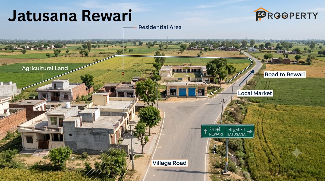
The place falls under the Rewari district and acts as an administrative center for the adjacent rural region. The area is made up of many villages including Berli Kalan, Palhawas Rewari, Rohrai, Rojhuwas, Nangal Pathani, Murlipur and Bawal Rewari. The place itself carries a village ambience where agricultural land and housing coexist. The place is connected to neighboring villages through local roads and also has access to Rewari and Kosli through other roads. In a search for a property, it is important to ascertain the village, khasra or plot that you are interested in as different properties in the wider block have varied environments and access facilities.
The Locality Guide
This place will be best suited for those who can tell apart village property from urban housing. The type of residential properties available includes individual houses, houses in villages, properties with land for agriculture, among others. Government and private schools make it easy to get basic education within the entire block while basic health care is available in the locality. Shopping needs of the place are catered to through local stores and nearby markets as opposed to organised shopping places. Potential buyers need to take note of the width of roads, drainage, availability of water and electricity, among others.
Locality Snapshot
Connectivity by Rail and Road
Nearby Villages and Localities
Nearby Residential and Commercial Development
Nearby Markets and Daily Needs
Nearby Temples
Nearby Parks and Recreation
Nearby Schools
Nearby Hospitals and Healthcare
Nearby Malls and Shopping Options
Jatusana Map and Directions
The map is especially helpful in this case, as it will allow you to navigate the area which is part of a larger system of villages and country roads and not a compact city. The roads connect the village to Rewari, Kosli and other neighboring villages, while the railway line is another way of transportation. The paths that lead to Nangal Pathani, Murlipur, Bhotwas-Babdoli and other neighboring places help you to integrate into the block. It is important to find out where exactly the plot is located relative to the railway station, road, school, hospital and the closest market.
What to Check Before Buying or Renting
Verify the exact village, property address and plot boundaries.
Check ownership and land records before making any commitment.
Confirm whether the land is residential, agricultural or subject to another land-use category.
Inspect the approach road and confirm practical vehicle access.
Check electricity, water supply and drainage arrangements.
Visit the property during both daytime and evening hours.
Check the distance to schools, healthcare and daily markets.
Confirm railway and bus connectivity for your regular travel needs.
Inspect the building condition, ventilation and structural maintenance.
For plots, verify the legal access road and applicable development requirements.
Frequently Asked Questions
1. Where is Jatusana located?
The locality is located in Rewari district, Haryana, in the rural plains of the region at approximately 28°20′N 76°33′E.
2. What is Jatusana known for?
The area is known for its role as a Gram Panchayat and administrative block, along with agriculture, rural communities and local education infrastructure.
3. What is the PIN code of Jatusana?
The postal PIN code for Jatusana, Rewari, Haryana is 123401.
4. What is the history of this location?
The Area has developed as an established rural settlement and administrative centre within Rewari district, with its identity closely connected to the surrounding agricultural communities.
5. How far is the location from Rewari?
The Location is located in the northern part of Rewari district, with road and rail connections linking it with Rewari city and nearby settlements.
6. What is Jatusana block?
Area block is an administrative area comprising the main settlement and numerous surrounding villages and Gram Panchayats under Rewari district.
7. What is the main occupation in the area?
Agriculture remains the primary occupation and an important part of the local economy, reflecting the predominantly rural character of the block.
8. Is there a railway station near the area?
Yes. Rail services from The Area connect the area with Rewari and other destinations, providing a regional transport option for residents.
9. Are there educational institutions in Jatusana?
Yes. The area has higher-education infrastructure, including a government college established in 2018, alongside local educational facilities.
10. What are the nearby places to visit around Jatusana?
The wider Rewari district contains several historical, cultural and recreational places. Visitors can explore these regional attractions while using part of their route through the district.
Conclusion
Jatusana provides a unique rural setting with schools, primary healthcare services, markets, roadways, and a train station in Rewari district. The surrounding block has several other villages where people who seek property have several options. On the other hand, individuals who need wide-ranging shopping, specialized healthcare, or education should consider the travel time to the nearby bigger cities.
One of the first things when searching for a property is the purpose of the property and its exact location. This involves checking the documents, accessing the infrastructure, checking the physical condition of the construction, and visiting the site at various times. Property searches can be made through the website of Prooperty.com to list out the required property.