Property logo
+91 9613488888info@prooperty.comUnit no. 5a, Tower B-4, Spaze iTech park Sector 49, Gurgaon, Haryana
No footer categories
GET THE APP
Terms of usePrivacy policy

RERA registration details are available on each project page. Prooperty verify listings to the best of their ability; prospective buyers should independently confirm title, approvals and RERA status before entering into any transaction. Prices and availability are indicative and subject to change.

About
+91 9613488888
EMI Calculator
Help
Post Property FREE
Property logo
Properties
Projects
Commercial
Localities
Blogs
Log inPost Property
  1. Home
  2. /Blog
  3. /Palhawas Rewari | Village, Rail Link & Rural Setting

Palhawas Rewari | Village, Rail Link & Rural Setting

Oct 3, 2026

Palhawas Rewari - explore its village profile, PIN code, railway station, administrative role, nearby settlements and connection with Rewari.

Palhawas Rewari | Village, Rail Link & Rural Setting

Palhawas Rewari Homes Connectivity

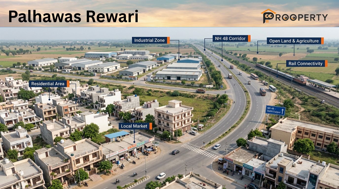
Palhawas Rewari Haryana is a big village and sub-tehsil in Rewari district of Haryana, lying at a distance of about 21.5 km from Rewari city towards North on Rewari-Jhajjar route. Extending over a geographical area of approximately 10 square kilometres, the village has a rural location and is surrounded by the villages like Rohrai, Kulana, Gurawra and Khera Alampur. Postal PIN Code for the locality is 123035, which is also applicable for other post offices in the vicinity. As per the 2011 Census Report, the village had a total of 4,563 inhabitants in 890 households with a literacy rate of approximately 85%. In addition to this, there is a railway station in Palhawas on the Rewari-Rohtak railway track. Administratively, it acts as a sub-tehsil and block area in Rewari district. Due to its location between Rewari and Jhajjar and due to railway link and existence of village infrastructure, it can be considered as a rural centre in southern Haryana.

Palhawas Map & Locality

Palhawas is a rural locality located in Rewari district with a number of other villages and farming areas around it. There is both traditional village housing and more recently built residential structures in the village, and farmlands are also present in the area around it. Roads in the area will give access to the village as well as to bigger roads connecting the village to Rewari and other parts of the district. This will result in there being a significant variation in property choices between the traditional village area, the roads to other settlements and the lands at the outskirts of the habitation.

Palhawas Locality Guide

This location provides a quieter village atmosphere compared to the urbanized sections of the Rewari district. The type of housing could range from village houses, new constructions, housing plots or rented dwellings with the agricultural land accounting for a significant portion of the surroundings. The local stores and facilities would usually cater for day-to-day needs, while for specialized medical care, higher learning institutions, more commercial facilities and employment, people could move to Rewari town or other neighboring towns. Those interested in acquiring a home here would have to look into school routes, availability of transport, water, electricity, sewage systems and roads among others. Whether the house is right for them will depend on how well the rural nature suits their daily commuting needs.

Locality Snapshot

Particular

Details

District

Rewari

State

Haryana

Locality Type

Village and rural settlement

Property Setting

Residential, village and agricultural surroundings

Property Types

Independent houses, village homes, residential plots and rental options

Land Use Around Settlement

Residential habitation and agricultural land

Education

Government and private schooling options in the wider area

Healthcare

Basic local facilities and healthcare services in nearby towns

Main Travel Links

Local roads, bus services and connecting district roads

Major Urban Centre Nearby

Rewari

Local Character

Rural residential and agricultural

Connectivity by Rail and Road

Transport Route

Importance

Local Village Roads

Connect residential areas with nearby settlements

Palhawas-Rewari Road Connections

Provide access towards Rewari and district-level services

Roads Towards Nearby Villages

Useful for local commuting and daily travel

Local Bus Services

Support movement between villages and nearby towns

Rewari Road Network

Provides access to wider road and transport connections

Rewari Railway Network

Useful for broader regional rail travel

Nearby Villages and Localities

Nearby Area

Local Relevance

Berli Kalan

Nearby settlement with residential and agricultural activity

Jatusana

Important nearby administrative and local service centre

Rohrai

Surrounding village area

Rojhuwas

Nearby rural settlement

Bhotwas Bhondu

Village area within the wider rural network

Nangal Pathani

Nearby settlement connected through local roads

Murlipur

Surrounding village area

Rewari City Haryana

Major urban and administrative centre

Kosli

Nearby town serving wider local requirements

Nearby Residential and Commercial Development

Area Type

What You May Find

Main Village Area

Existing houses, village homes and local shops

Outer Residential Streets

Newer houses and residential plots

Main Connecting Roads

Small shops and service businesses

Roads Towards Nearby Villages

Mixed residential and agricultural land

Village Market Area

Daily-use retail and local services

Rewari-Side Connections

Greater residential and commercial activity closer to urban areas

Agricultural Edge

Farmland and larger parcels requiring land-use verification

Nearby Markets and Daily Needs

Shopping Area

Typical Requirements

Local Village Market

Groceries, household products and everyday shopping

Main Road Shops

Food, repair services and convenience items

Pharmacy and Medical Shops

Routine medicines and basic healthcare products

Nearby Village Markets

Additional daily-use shopping

Jatusana Rewari Market

Broader local retail requirements

Rewari Markets

Larger retail, specialised shopping and services

Nearby Temples

Religious Place Type

Local Relevance

Village Temples

Regular worship and community gatherings

Shiv Temples

Common local places of worship

Hanuman Temples

Religious and community use

Temples in Nearby Villages

Additional worship options within the surrounding area

Larger Religious Sites

Additional options across the wider Rewari region

Nearby Parks and Recreation

Recreation Option

Suitable For

Village Open Spaces

Walking and informal outdoor activity

Local Play Areas

Children and young residents

School Grounds

Sports and community activities where permitted

Agricultural Surroundings

Open rural landscape and outdoor setting

Parks in Nearby Towns

Organised recreation and larger green spaces

Rewari Recreation Facilities

Wider leisure and sports choices

Nearby Schools

Schooling Option

Local Relevance

Government Schools

Local schooling for children

Government Schools in Nearby Villages

Additional primary and secondary options

Schools in Jatusana

Wider schooling choices within the nearby service centre

Private Schools

Additional education options in the wider area

Schools in Rewari

Broader range of educational institutions

Nearby Hospitals and Healthcare

Healthcare Option

Typical Use

Local Health Facilities

Basic healthcare requirements

Nearby Primary-Level Facilities

Routine and first-level medical needs

Local Clinics

General consultation and common illnesses

Pharmacies

Medicines and everyday healthcare products

Healthcare in Jatusana

Additional local medical services in Bawal Rewari

Hospitals in Rewari

Broader hospital and specialist services

Nearby Malls and Shopping Options

Shopping Destination

Purpose

Local Village Shops

Everyday groceries and household requirements

Village Market

Routine retail and local services

Jatusana Market

Broader local shopping

Rewari Commercial Areas

Larger retail and specialised services

Rewari Shopping Destinations

Branded shopping and entertainment

Regional Markets

Wider range of products and services

Palhawas Map and Directions

The settlement is also linked through roads connecting the settlement with villages such as Jatusana and Rewari and other places nearby. These roads enable the people living there to move around to various places including schools, market, work places, health care centers and other public amenities. Since this area is rural in nature, there is a possibility that the final stretch of roads leading to individual plots may vary in terms of width and condition of access. One must thus check the property maps including the access road and other reference points.

For buyers and renters, it would be helpful to mark their place of work, school, hospital, railway station, market and other commonly visited places before selecting any particular plot. Check the actual journey during your expected journey time especially during the morning and evening. Also check the availability of transportation facilities from the plot of land selected.

1. Where is Palhawas located?

The Area is situated in Rewari district, Haryana, along the Rewari–Jhajjar road, approximately 21.5 km north of Rewari city.

2. What is the PIN code of Palhawas?

The postal PIN code is 123035, which also serves some surrounding post offices in the area.

3. How far is Palhawas from Rewari?

The village is approximately 21.5 km from Rewari city by road.

4. Which tehsil does Palhawas come under?

The Area functions as a sub-tehsil in Rewari district and also serves as an administrative block area.

5. Does the location have a railway station?

Yes. Railway Station is situated on the Rewari–Rohtak railway line and serves the surrounding settlements.

6. What is the location known for?

The area is known as a large rural settlement, sub-tehsil and local transport centre with established administrative and railway connections.

7. What is the population of this area?

The 2011 Census recorded 4,563 residents living across 890 households. The reported literacy rate was around 85%.

8. What villages are near Palhawas?

Nearby settlements include Rohrai, Kulana, Gurawra and Khera Alampur, forming part of the surrounding rural landscape.

9. In which direction is Palhawas from Rewari?

It lies to the north of Rewari city, along the route towards Jhajjar.

10. Where is Palhawas Railway Station located?

The station is located within the settlement and lies on the Rewari–Rohtak railway line, serving local rail movement in the surrounding area.

Conclusion

Palhawas Rewari provides a rural residential setting in the larger context of the Rewari district, where there are villages, farms, markets, schools, and facilities to assist in the daily needs of its occupants. Due to the linkages with other villages like Jatusana and Rewari, it becomes possible for the inhabitants of the area to have access to more educational, health, and job opportunities.

Leave a Comment

3 October 20267 min read
Latest

Recent Articles

  • Palhawas Rewari | Village, Rail Link & Rural Setting

    Palhawas Rewari | Village, Rail Link & Rural Setting

    3 Oct 2026
  • What Makes an Online Real Estate Listing Useful for Buyers? | Prooperty

    What Makes an Online Real Estate Listing Useful for Buyers? | Prooperty

    3 Oct 2026
  • Bawal Rewari | Industrial Township & Historic Legacy

    Bawal Rewari | Industrial Township & Historic Legacy

    3 Oct 2026
  • Jatusana Rewari | Rural Administration & Local Profile

    Jatusana Rewari | Rural Administration & Local Profile

    3 Oct 2026
Subscribe

Newsletter

Stay updated with our latest market analysis and insights.