Property logo
+91 9613488888info@prooperty.comUnit no. 5a, Tower B-4, Spaze iTech park Sector 49, Gurgaon, Haryana
No footer categories
GET THE APP
Terms of usePrivacy policy

RERA registration details are available on each project page. Prooperty verify listings to the best of their ability; prospective buyers should independently confirm title, approvals and RERA status before entering into any transaction. Prices and availability are indicative and subject to change.

About
+91 9613488888
EMI Calculator
Help
Post Property FREE
Property logo
Properties
Projects
Commercial
Localities
Blogs
Log inPost Property
  1. Home
  2. /Blog
  3. /Bawal Rewari | Industrial Township & Historic Legacy

Bawal Rewari | Industrial Township & Historic Legacy

Oct 3, 2026

Bawal Rewari - discover its NCR setting, industrial landscape, highway links, historic fort and regional importance near Rewari and Gurugram.

Bawal Rewari | Industrial Township & Historic Legacy

Bawal Rewari Locality for Homes

Bawal Rewari Haryana is an industrial town and tehsil of Rewari district in the state of Haryana and situated in the National Capital Region on National Highway 48. The distance from Rewari is 11 km and that from Gurugram 50 km whereas from New Delhi it is 91 km. The PIN code is 123501. The town has emerged as a town having a prominent industrial profile as an industrial model township wherein industries and their economic activities are an important part of the townscape. In addition to its industrial profile, the place has a rich history including Fort of the area which was built in 1875 by Nabha chief Hira Singh in stone and slate masonry. Traditionally, the place belonged to the larger Veer Bhoomi area and has transformed itself from being a place of princely past to becoming an important manufacturing hub in south Haryana. Its strategic location in Delhi-Jaipur corridor, proximity to Rewari and association with the larger NCR have made it an important place in the region.

Bawal Map & Locality

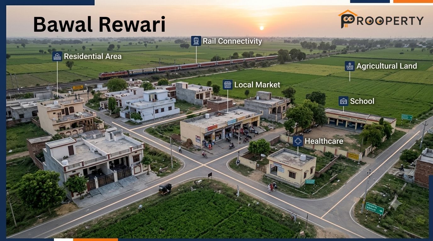
The place of Bawal is situated in the southern portion of Rewari district and acts as an important urban and industrial center in the broader Rewari region. The main town has residential areas, business centers, educational institutions, health care facilities, and general shops. However, the surroundings consist of villages, agriculture fields, and industries. NH 48 is the major route of the region and acts as a feasible path to reach Rewari and in the Delhi-Gurugram-Jaipur direction. The other transportation options include railway station, while Rewari has better transport and urban facilities. While looking for a map of any property, one needs to consider the specific sectors, roads, plot numbers or colonies.

Bawal Locality Guide

This region provides a mix of traditional town life with planned industrial activity and adjacent rural communities. The residential real estate may comprise individual houses, builder floors, plots, small homes and rentals, whereas commercial real estate exists on active streets and markets. Industrial activity will result in the need for employees, companies, suppliers and service providers. This makes the site suitable for both residential and commercial real estate searches. Everyday needs can be met in the town itself, while healthcare facilities, education, shopping and specialized services might require visits to Rewari or other nearby towns. Before choosing any property, compare its travel distance, road width, water availability, electricity, drainage, parking and adjacent land use rather than considering only the site on the map.

Locality Snapshot

Particular

Details

District

Rewari City

State

Haryana

Locality Type

Town and industrial centre

PIN Code

123501

Property Setting

Residential, commercial, industrial and surrounding rural areas

Property Types

Houses, builder floors, plots, apartments, commercial properties and rental options

Education

Government and private schools

Healthcare

Local clinics, health facilities and hospitals nearby Rewari

Main Travel Links

NH 48, local roads, bus services and railway

Major Urban Centre Nearby

Rewari

Industrial Influence

Established industrial development around IMT

Connectivity by Rail and Road

Transport Route

Importance

Railway Station

Local rail connectivity for passenger movement

NH 48

Major road corridor towards Rewari, Dharuhera, Gurugram and Jaipur-side destinations

Bawal-Rewari Road

Important connection with Rewari and surrounding settlements

Industrial Area Roads

Connect residential areas with employment and manufacturing zones

Local Bus Services

Useful for movement between, Palhawas Rewari and nearby areas

Rewari City Junction

Larger railway hub for wider regional rail travel

Nearby Villages and Localities

Nearby Area

Local Relevance

Jalalpur

Nearby settlement with residential and local-use activity

Jaliawas

Located close to the town and industrial belt

Suthana

Nearby settlement associated with the wider industrial area

Banipur

Surrounding village area

Chirhara

Nearby rural settlement

Rudh

Village area around the area

Dharuhera

Important urban and industrial centre towards the north

Rewari

District headquarters and major service centre

Neemrana

Important industrial and commercial centre towards Rajasthan

Nearby Residential and Commercial Development

Area Type

What You May Find

Established Town Areas

Independent houses, older homes, shops and local residential properties

Main Road Corridors

Retail shops, offices, service businesses and commercial properties

Railway Station Side

Residential pockets, small shops and transport-related activity

Industrial Area Side

Worker housing, commercial services, warehouses and business activity

Residential Colonies

Plots, houses, builder floors and rental properties in Bawal and near by Jatusana Rewari

Surrounding Village Areas

Larger plots, village homes and agricultural land

Rewari Road Side

Mixed residential and commercial development

Nearby Markets and Daily Needs

Shopping Area

Typical Requirements

Main Town Market

Groceries, clothing, household goods and everyday shopping

Local Residential Markets

Grocery stores, pharmacies and daily-use services

Main Road Shops

Retail, repair services, food outlets and small businesses

Railway Station Area

Convenience stores, food and travel-related services

Industrial Area Commercial Pockets

Worker-oriented shops, food outlets and service businesses

Rewari Markets

Larger retail, branded shopping and specialised services

Nearby Temples

Religious Place Type

Local Relevance

Local Temple Areas

Regular worship and community activities

Shiv Temples

Common religious spaces within the town and surrounding settlements

Hanuman Temples

Local places of worship

Village Temples

Community-oriented religious spaces in nearby villages

Larger Religious Sites

Additional options available across the wider Rewari region

Nearby Parks and Recreation

Recreation Option

Suitable For

Local Parks

Morning walks, children and routine outdoor activity

Residential Open Spaces

Informal recreation and community use

Village Open Areas

Outdoor activity and local community gatherings

Sports Grounds

Children and young residents

Rewari Recreation Facilities

Larger range of organised recreational options

Nearby Schools

Schooling Option

Local Relevance

Government Middle School,

Schooling option within the town

Government Girls Senior Secondary School,

Girls' senior secondary education

Government Senior Secondary Schools

Schooling options in and surrounding areas

Government Schools in Nearby Villages

Primary and secondary education around the wider area

Private Schools

Additional schooling choices within and around Bawal

Schools in Rewari

Wider range of educational options for families willing to commute

Nearby Hospitals and Healthcare

Healthcare Option

Typical Use

Local Health Facilities

Basic healthcare requirements

Primary-Level Health Services

Routine and first-level medical needs

Local Clinics

General consultations and common health concerns

Pharmacies

Medicines and everyday healthcare products

Hospitals

More developed medical requirements within or around the town

Rewari Hospitals

Broader specialist and hospital services

Nearby Malls and Shopping Options

Shopping Destination

Purpose

Main Market

Everyday shopping and local retail

Main Road Commercial Areas

Retail and service requirements

Local Shopping Streets

Groceries, clothing and household products

Industrial-Area Retail Pockets

Food, convenience and worker-oriented services

Rewari Commercial Areas

Larger shopping and specialised retail

Regional Shopping Destinations

Broader branded and entertainment options

FAQ

1. Where is Bawal located?

The area is situated in Rewari district, Haryana, within the National Capital Region and along National Highway 48.

2. What is Bawal famous for?

The town is particularly known for its industrial base, Industrial Model Township, manufacturing activity and the historic Fort of Bawal.

3. How far is Bawal from Rewari?

The area is approximately 11 km from Rewari city, making it closely connected with the district headquarters.

4. How far is Bawal from Gurugram?

The town is around 50 km from Gurugram, with the highway network providing a direct regional connection.

5. What is the PIN code of Bawal?

The PIN code for Bawal is 123501.

6. What is Bawal in Haryana known for industrially?

The area is known for the Industrial Model Township, which has attracted manufacturing units and supporting industrial activity across multiple sectors.

7. What is the history of this area?

The town has historical links with the princely-era administration of the region. Its notable heritage structure, the Fort of Bawal, was built in 1875 by Nabha chief Hira Singh.

8. What is the Fort of Bawal?

The Fort is a historic structure built in 1875, featuring stone and slate masonry and representing an important part of the town's heritage.

9. Is area part of the NCR?

Yes. it lies within the National Capital Region and has road connections towards Rewari, Gurugram, Delhi and the Rajasthan side.

10. What are the main places to visit in Bawal?

The Fort is the principal historical landmark associated with the town. Visitors can also explore the surrounding local areas and regional attractions across Rewari district.

Conclusion

The combination of traditional town life with an existing industrial setting and good road connectivity within the region makes them an ideal place for families, working professionals, renters and home buyers. On the other hand, the nature of places within and can differ widely depending upon the location's relation with the highway, the railway line, industrial zones, residential areas and villages around the place.

If you are thinking about buying property in Bawal, look into the specific location of the property rather than just its name. Check the property against your work location and traveling routes, road connectivity and other utility services, verify land and title deeds and check nearby educational institutions, healthcare and shopping centers. Use Prooperty.com to know more about different properties available and then select according to location, budget, property type and your needs.

Leave a Comment

3 October 20267 min read
Latest

Recent Articles

  • Palhawas Rewari | Village, Rail Link & Rural Setting

    Palhawas Rewari | Village, Rail Link & Rural Setting

    3 Oct 2026
  • What Makes an Online Real Estate Listing Useful for Buyers? | Prooperty

    What Makes an Online Real Estate Listing Useful for Buyers? | Prooperty

    3 Oct 2026
  • Bawal Rewari | Industrial Township & Historic Legacy

    Bawal Rewari | Industrial Township & Historic Legacy

    3 Oct 2026
  • Jatusana Rewari | Rural Administration & Local Profile

    Jatusana Rewari | Rural Administration & Local Profile

    3 Oct 2026
Subscribe

Newsletter

Stay updated with our latest market analysis and insights.