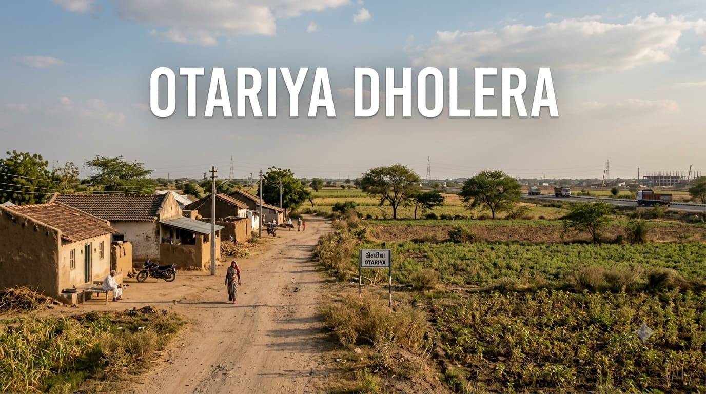
Otariya Dholera Village and Land Assessment
Otariya Dholera is located in the rural environment around the area of the development region of Dholera SIR in Gujarat. Existing settlements and cultivated land are increasingly being looked at in relation to their infrastructure. The current village status of Otariya Dholera is important for location studies in relation to the overall development going on in the Dholera SIR area. From the point of view of a prospective purchaser, this makes the locality better suited for land appraisal than just price comparison. Not only does the location of the village need to be assessed, but also the impact of access and surrounding development and planning on individual plots.
The Village in Its Wider Setting
Otariya should be looked at as just one part of the Dholera regional landscape, and not as an urbanized settlement on its own. The surrounding landscape includes rural settlements, agricultural lands, and lands that come under the planning framework of the wider area. As development takes place in certain regions of the Dholera region, it becomes increasingly important to understand the correlation between villages and development for the purposes of property research. But this does not necessarily mean that any development influence implies urbanization. A village could be located near a development region, but the individual properties in the village would remain agricultural lands.
This is especially so when advertisements refer to land in generic terms like Dholera, smart city, or development zone. The suitability of the property depends on the survey of the property and its land classification, as well as planning regulations.
Locality Snapshot
Rural nature of the locality constitutes another factor worth considering in connection with its land characteristics. It should be noted that agricultural use and settlement practices may exist together with an extremely big-scale approach to development, thus forming a landscape that may change over time gradually but not immediately. For buyers this implies that images, distances to roads and projections of further development should not be considered as the only evidence of future usability of the land. Location of the piece of land in relation to the rest of the village plays a crucial role.
Localities Nearby with Distances
It should be noted that distance measurements in the Dholera area may vary in case of the route taken and the point from which distance is measured. The following values are indicative for the region and should be used for preliminary location research only.
Major Connectivity Points with Distance
Connectivity is one of the most important variables in land assessment because accessibility can influence both practical usability and future interest. Otariya's connectivity should be considered through its links with nearby settlements and the wider road network serving the Dholera region. Strategic infrastructure associated with Dholera can also be relevant when considering the area's long-term economic geography.
How Infrastructure Can Influence Land
The infrastructure plays a key role in the life of Otariya as any kind of development can affect the accessibility and economic situation of the land that surrounds the place. The development of roads, infrastructure, industries, and utilities can slowly affect the relationship of the rural area with its surroundings. However, this does not happen equally everywhere. The area which benefits from better accessibility will be different from those that do not.
Infrastructure Factors to Monitor
Road improvements connecting the village with wider Dholera development areas.
Accessibility to major regional routes serving the Dholera region.
Expansion of infrastructure supporting industrial and economic activity.
Availability and extension of essential utilities.
Development activity in surrounding designated areas.
Changes in accessibility created by completed infrastructure rather than only proposed projects.
What Infrastructure Does Not Automatically Mean
A planned road does not automatically make every nearby plot commercially viable.
Being within the broader Dholera region does not guarantee residential approval.
Proximity to a development corridor does not establish a property's legal land-use status.
Future infrastructure announcements should not be treated as guaranteed appreciation.
A low asking price should not automatically be interpreted as an investment opportunity.
Assessing Land Before Considering Price
Assessment of the land in Otariya should consider legal and physical features of land instead of the stated rate. The first thing to do would be to know which specific plot of land one is considering and its ownership. Then, one needs to check whether the land is agricultural or other land and what purposes the land can be used for under the applicable planning laws. Access becomes an important feature since sometimes the land may look like it is well placed but there might not be good legal and physical roads to access it. This becomes all the more important when someone is trying to acquire land for some future residential or commercial use.
Comparison with the market value of the Dholera Residential Project in Gujarat would also be helpful for people making decisions between developed and undeveloped property. The residential project and rural land are two different property options with varying degrees of development and usability. Comparing them just based on cost could lead one to wrong conclusions. One should first have a use in mind and then make comparisons.
A Land Assessment Checklist
Verify the seller's ownership and title documents.
Match the property advertisement with the exact survey or parcel details.
Confirm the current land classification.
Check applicable planning and land-use provisions.
Establish whether the proposed use is legally permissible.
Verify physical and legal road access.
Investigate existing mortgages, disputes or other encumbrances.
Check whether conversion or development permissions are necessary.
Review the surrounding land-use pattern before making assumptions about future demand.
Obtain independent legal and planning advice before completing the transaction.
Understanding the Dholera Development Relationship
The overall story of the dholera smart city project might help in making places around the region interesting for the study of property by the researcher, but the term needs to be understood within the actual context of planning and development. Development in dholera occurs through the planning and development of a regional ecosystem with industrial use, infrastructure, and urban activities as well. There are certain benefits that may arise due to such an ecosystem and they will come gradually depending upon how much infrastructure and economy develops.
In the case of Otariya, the important thing to look at is how these two things relate with the village and its individual parcels rather than the whole locality becoming an urban area in future.
Frequently Asked Questions
Where does Otariya fit within the Dholera region?
Otariya forms part of the wider village landscape associated with the Dholera development region in Gujarat. Its property relevance comes from its relationship with the broader Dholera planning and infrastructure ecosystem.
Is land in Otariya automatically suitable for residential development?
No. The intended use of a particular parcel depends on its classification and applicable planning provisions. Buyers should verify the exact property rather than relying on the village's association with Dholera.
What should I examine before purchasing land?
Ownership, title, survey details, land classification, road access, planning status and permitted use should all be checked. Any relevant conversion or development permissions should also be confirmed.
Does infrastructure guarantee property appreciation?
No. Infrastructure can influence accessibility and economic activity, but it does not guarantee an increase in property value. Actual development and market demand need to be monitored.
Is Otariya suitable for comparing land and residential projects?
Yes, but the two should be evaluated differently. Land may require additional planning and development checks, while a residential project should be assessed according to its approvals, infrastructure, developer information and actual project status.
How should buyers use advertised plot prices?
Advertised prices should be treated as preliminary market information rather than confirmed values. Buyers should compare properties with similar legal, planning and accessibility characteristics before assessing whether a quoted price is reasonable.
Conclusion
Otariya presents a unique viewpoint in property-research as a result of its rural nature, which happens to be part of the larger picture of development called Dholera. While infrastructure and economic activities in the region may impact future accessibility and demand, these considerations need to be considered together with the true nature of each parcel of land. In any case, the best way for the prospective buyer is to confirm the ownership, land use and access to the parcel prior to looking into further development. At the same time, people seeking to compare properties with residential prospects can use websites like Prooperty.com. Nevertheless, the true importance of analyzing Otariya is to understand the connection between the current nature of the land and the bigger Dholera picture.