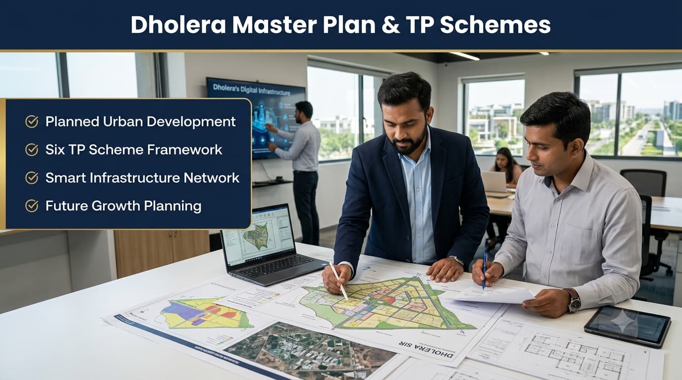
Dholera is an example of planned development wherein the process of development takes place via urban planning, infrastructure connections, and zoning for different uses of land. Located in Gujarat, Dholera SIR has been planned to be developed as an area for industry and economic development as part of the DMIC. It is significant to understand the Master Plan and TP Schemes as the plan for Dholera is different from that of the other existing cities. Rather than having conventional sectors and localities, Dholera's development takes place through TP Schemes, final plot numbers, survey information, and land use types. Dholera SIR is developed through a structured administrative and planning framework involving dedicated authorities responsible for planning and implementation. The planning framework of Dholera SIR is designed to coordinate industrial growth, urban infrastructure, transportation systems, and supporting facilities through a long-term development strategy. Unlike traditional cities where people search through sectors, colonies, or neighbourhood names, Dholera follows a planning-based identification system. The major reference points used for understanding land and development areas include: TP Scheme number Final Plot (FP) number Survey number Village location Land-use zone It is significant because, unlike mature urban centers, Dholera does not have any officially notified localities by sector. The villages in SIR area make up the geographic base, while these Schemes will provide the blueprint of the infrastructure development and land development. The 22 villages that make up Dholera SIR make up the geographic base of the planning process. Some of the important villages associated with SIR are Dholera, Ambli, Bavaliyari, Bhadiyad, Kadipur, Gogla, Otariya, and other surrounding villages. But the villages need to be considered only as part of the planning process. The Dholera Master Plan is the development plan that provides guidelines for the planning and utilisation of various zones in the SIR. The goal of the Master Plan is to ensure the establishment of an organised ecosystem of industrial activities where industries, business organisations, residential populations, and infrastructure facilities can work cohesively. This means that rather than unorganised development, the master plan focuses on zones, road network, utilities, and land development. The Master Plan also assists in the realisation of the vision of the creation of an industrial city that has modern infrastructure with plans of road networks, technology-driven system, and zones of various economic activities. TP Schemes are a systematic approach that can be followed to plan land development through road planning and infrastructure and land use planning in specific regions. In the case of the Dholera SIR, TP Schemes have an important part to play in bringing the vision of the Master Plan into development zones. TP Schemes help to plan the process of infrastructure development and land usage. TP Scheme 1 TP Scheme 2 TP Scheme 3 TP Scheme 4 TP Scheme 5 TP Scheme 6 These basic schemes are then classified into sub-TP schemes like TP-1A, TP-1B, TP-2A, TP-2B, TP-5A, TP-5B, and so on to facilitate administration and implementation of the schemes. Such sub-schemes are only parts of the basic TP and not independent schemes. The scheme structure makes Dholera an exceptional city from traditional city planning in that it offers a systematic arrangement wherein one can monitor the development process through planning zones, ultimate plots, and infrastructure corridors. The Dholera Special Investment Region has been planned by dividing it into six main TP Schemes to plan the development of land, infrastructure, and future development. These Schemes serve as the operational mechanism of the Master Plan by setting up development limits, road systems, land use, and infrastructure. Each main TP is sub-divided into sub-TP Schemes, which help in planning activities effectively but are not regarded as separate TP Schemes. The six TP Schemes together create the planning foundation for the developable area of Dholera SIR. Among these, TP-1 and TP-2 are considered part of the initial development phase, while other Schemes support future expansion and planned growth. TP Scheme 1 is a significant one of those planned areas in Dholera SIR that occupies an approximate area of around 51.4 sq. km. The TP Scheme 1 also consists of inputs from various villages, reflecting on how the planning mechanism of Dholera takes inputs from different village areas into account. The planning process used in TP 1 shows the land pooling and systematic development principle applied at Dholera. In contrast to the treatment of individual villages as discrete units, the TP system allows for the integration of land parcels into a comprehensive infrastructure system with roads and development zones. TP 2 is another major planning zone within Dholera SIR, covering an approximate area of around 102.34 sq km. It includes contributions from several Dholera villages, making it one of the larger TP areas under the overall development framework. The size and village contribution pattern of TP 2 highlight the integrated nature of Dholera planning. The scheme combines multiple land parcels while creating a structured framework for future infrastructure, development zones, and connectivity. The TP 3 is one of the six major TP planning zones in Dholera SIR. Just like other Schemes, it is meant to facilitate organized development through proper planning of infrastructure, land-use and growth. It is important that the specific contributions of the villages and the allocation of the areas in Scheme 3 are looked into through planning documents since developments can change from time to time. TP 4 falls under the ambit of Dholera SIR Planning Scheme and helps to build upon the vision for systematic urban and industrial development. The scheme adheres to the principles of planning which include land use planning, infrastructure corridors, and Dholera connectivity planning. Just like the other future stage Schemes, the role of development in this scheme is linked with the expansion plan of Dholera SIR. TP Scheme 5 is one of the major planned areas within the six TP Scheme framework and is further divided into multiple sub-sections, including: TP-5A TP-5B TP-5C TP-5D These subdivisions allow better management of planning activities and infrastructure execution. The scheme forms part of the wider development strategy where different land-use categories and infrastructure systems are planned according to the Master Plan. TP Scheme 6 completes the six primary TP Scheme structures of Dholera SIR. Similar to other schemes, it supports future planned development through organised land planning, infrastructure integration, and Dholera connectivity frameworks. It is further divided into: TP-6A TP-6B These subdivisions help authorities manage planning and implementation activities while maintaining consistency with the overall Dholera Master Plan. The Scheme is one of the key aspects when it comes to discussing Dholera SIR. In a normal city, one would identify the location based on either the sectors or the name of the neighborhood. But in the case of Dholera, the identification is done through planning and is a combination of TP Scheme, villages, land-use zone, and Final Plot. This method of location identification helps achieve a coherent development process whereby the roads, utilities, industrial, commercial, and residential development is incorporated in a coordinated way. This method makes sure that future developments are also done in a coordinated way and not just any random development here and there. The Dholera Master Plan is a land-use plan that segregates zones based on the intended use for the future. Unlike haphazard development, the land use plan segregates residential, commercial, industrial, knowledge-based, and logistic zones to develop in a more organized manner. Such a segregation facilitates an ecosystem where the industries, business, and people will work together efficiently. Such zones need to be developed as per the Master Plan but not as colonies or localities. The residential zones that will be developed in Dholera are those that will cater to the workforce and professional community that will emerge due to future development in industrial and urban sectors. These zones are provided with the infrastructure facilities required, including roads, utilities, public facilities, and other necessary services. Residential land-use zones have been identified in the Master Plan especially in Phase-I and Activation Area developments. These residential zones are conceived as part of the city plan as a whole and not as separate residential colonies. Private developers may refer to nearby villages while referring to their projects' locations, but the official reference for residential zoning will still be TP Scheme number, final plot number, and land-use zones. Commercial planning in Dholera focuses on creating dedicated business and service areas that can support economic activities generated by industrial and urban development. The Master Plan includes multiple commercial concepts designed to provide organised spaces for offices, businesses, services, and daily economic activities. Major planned commercial areas include: These commercial zones are designed to support the functioning of a large-scale industrial city by providing business infrastructure close to employment and development areas. Industrial development is one of the primary focuses of the Dholera Master Plan. The industrial zones are planned to support multiple sectors and create an integrated manufacturing and business ecosystem. The planned industrial categories include: These industrial zones are planned as part of the wider economic development strategy of Dholera SIR, supporting employment generation, manufacturing growth, and industrial connectivity. Knowledge & IT Zone refers to the technology-based aspect of Dholera’s overall development plan. This zone is supposed to help innovation and technology-based companies in addition to research and development activities and economy based on knowledge. This zone’s aim is to establish a link between the industrial development and technology ecosystem. Through the use of knowledge-based activities along with infrastructure, futuristic industries and services will be supported by Dholera. The Logistics Zone is planned to support movement, storage, and supply chain operations required for industrial growth. Since Dholera is being developed as an industrial region, efficient logistics infrastructure plays an important role in connecting manufacturing activities with transportation networks. The logistics planning includes: Warehousing facilities Supply chain support systems Industrial transportation movement Connectivity with major road networks This zone helps strengthen the overall industrial ecosystem by improving the movement of goods and supporting large-scale economic activities. One such characteristic of the Dholera Master Plan includes the systematic arrangement of roads hierarchy. Rather than relying on the current roads, various road widths and connections have been planned for the city to cater to the future movement needs. There is a systematic hierarchy of roads, starting from bigger corridors, leading to small internal roads, and finally linking the developments and Final Plots. Ahmedabad Dholera Expressway is a key regional connectivity project that links Dholera with Ahmedabad and provides improved connectivity with other parts of Gujarat's transportation network. The corridor also serves as a key linkage for movement of industries and businesses. SH-6 Central Spine acts as a key internal connectivity link in the proposed road network. It links various developments and helps in movement between various zones of Dholera SIR. The complete hierarchy works through a structured system: Ahmedabad–Dholera Expressway (NH-751) This planned connectivity structure allows Dholera to develop as an organised urban and industrial region where transportation infrastructure supports future growth. Dholera TP Map is one of the significant planning documents which are useful for comprehending the planning arrangement within the SIR. As compared to the conventional map of a city which mainly consists of sectors, streets, and localities, TP Maps are made with an emphasis on planning limits, plots, road networks, and development zones. The TP Map gives data regarding the association between various planning elements like TP Scheme Limits, villages, Final Plot Numbers, Survey Number, Road Corridor, and Land Use. For any individual attempting to learn a particular location in Dholera SIR, it would be more helpful to analyze the TP Map. The main elements generally identified through TP Maps include: Understanding a TP Map requires a planning-based approach rather than a normal city map approach. The following steps help in analysing a location: The first step is to identify which TP Scheme covers the particular location. Dholera SIR is divided into six main TP Schemes, and every planned area falls under one of these frameworks. Villages form the base geographical structure of Dholera SIR. A location may be associated with a Dholera village name, but the village alone does not define the complete planning identity. Final Plot (FP) Number is one of the most important references in Dholera planning. It helps identify the specific planned land parcel after the TP process. The land-use zone provides information about the planned purpose of the area, such as: Residential use Commercial development Industrial activities Logistics Knowledge and technology-related activities Road hierarchy plays an important role while understanding any TP Map. The surrounding road network, including major corridors and internal roads, helps identify accessibility and development potential. Many established cities use sectors, colonies, and locality names for identification. However, Dholera follows a different planning structure because it is being developed as a Special Investment Region through a Master Plan and TP Scheme framework. This difference is important because searching for a location in Dholera requires understanding its official planning references rather than relying only on commonly used market names. There are quite a few structural benefits of Dholera’s planned development strategy because there is an organizational structure that will be followed before extensive growth takes place. This contrasts from regions where the growth process lacks any organized planning. Major benefits include: The combination of TP Schemes, land-use planning, and infrastructure hierarchy creates the foundation for Dholera's long-term development model. The choice of the most appropriate TP Scheme for Dholera can be done based on the objective, level of development, requirements of connectivity, and planning objectives rather than one scheme being better than others as a whole. As the development of Dholera SIR is based on the Master Plan, each TP plays its own role in the entire planning process. While considering any TP Scheme, key considerations include proximity to infrastructure, type of land use zone, connectivity of roads, phase of development, and availability of supporting facilities. The significance of TP-1 and TP-2 lies in their association with the initial phase of development, whereas TP-3, TP-4, TP-5, and TP-6 are significant as they relate to the expansion of Dholera SIR. Before evaluating any location within Dholera, users should focus on official planning references such as: TP Scheme number Final Plot (FP) Number Survey details Land-use category Road connectivity Development status A proper understanding of these factors provides a more accurate picture than simply comparing TP numbers. Dholera Master Plan and TP schemes are a systematic manner in which the industrial and urban area of Dholera SIR in Gujarat is developed. Unlike other cities, which develop on sectors and localities basis, the development of Dholera is done according to the system of the schemes, Final Plot Nos, land use zones, and corridors. This knowledge will help the reader understand the region systematically and not get confused due to the unauthorised locations of the region. The six basic TP schemes, systematic land use planning, industrial areas, commercial areas, residential planning, and systematic road hierarchy constitute the building blocks of Dholera SIR development. Since the region is developing systematically, it becomes necessary for evaluating any location to take into account the systematic planning aspects as well as the market aspects. Those seeking to have easy-to-understand information regarding systematic development and documentation may visit Prooperty.com as well. The Dholera Master Plan is a comprehensive development framework that defines land use, infrastructure planning, transportation networks, industrial zones, commercial areas, and urban development structure within Dholera SIR. Dholera Special Investment Region covers approximately 920 sq km, with around 422 sq km identified as developable area under the planned development framework. Dholera SIR has six main Schemes: TP Scheme 1, TP Scheme 2, TP Scheme 3, TP Scheme 4, TP Scheme 5, and TP Scheme 6. A sector is commonly used in established city planning, while Dholera uses TP Schemes as the primary planning structure. A Scheme defines development boundaries, infrastructure planning, and land-use organisation. Dholera SIR covers 22 villages, including Dholera, Ambli, Bavaliyari, Bhadiyad, Kadipur, Gogla, Otariya, and other surrounding villages forming the geographical base of the SIR. TP Schemes help organise land development by planning infrastructure, roads, land-use distribution, and development boundaries in a systematic manner. A Dholera TP Map shows planning details such as TP boundaries, Final Plot numbers, survey references, road networks, and designated land-use zones. Major planned land-use categories include residential zones, commercial areas, industrial zones, knowledge and IT zones, and logistics zones. The Ahmedabad–Dholera Expressway improves regional road connectivity by connecting Dholera with Ahmedabad and supporting industrial movement, business activities, and infrastructure development. A location in Dholera should be verified using official planning references such as TP Scheme number, Final Plot number, survey details, land-use category, and applicable development records.Dholera Master Plan & TP Schemes: Complete Guide
Dholera SIR Administrative Profile
Understanding Dholera Planning Framework
What is the Dholera Master Plan?
What are TP Schemes in Dholera?
Dholera SIR has six main TP Schemes:
Overview of Six Main TP Schemes in Dholera
TP Scheme 1
TP Scheme 2
TP Scheme 3
TP Scheme 4
TP Scheme 5
TP Scheme 6
Understanding TP Scheme Development Approach
Dholera Land Use Plan
Residential Zones
Commercial Zones
Industrial Zones
Knowledge & IT Zone
Logistics Zone
Dholera Road Hierarchy and Connectivity Planning
Ahmedabad-Dholera Expressway (NH-751)
SH-6 Central Spine
Planned Road Hierarchy
↓
Central Spine (SH-6)
↓
Grade Separated Interchanges
↓
70 m Roads
↓
55 m Roads
↓
45 m Roads
↓
36 m Roads
↓
30 m Roads
↓
24 m Roads
↓
Final Plots / BuildingsUnderstanding Dholera TP Maps
How to Read a Dholera TP Map
Identify the TP Scheme Number
Check Village Reference
Verify Final Plot Number
Understand Land Use Category
Analyse Road Connectivity
Why Dholera Does Not Have Sector-Based Planning
Dholera Master Plan Benefits
Which TP Scheme is Best?
Conclusion
Frequently Asked Questions
What is the Dholera Master Plan?
How large is Dholera SIR?
How many TP Schemes are there in Dholera?
What is the difference between a TP Scheme and a sector?
Which villages are included in Dholera SIR?
What is the purpose of TP Schemes in Dholera?
What does a Dholera TP Map show?
What are the major land-use zones in Dholera?
What is the role of the Ahmedabad–Dholera Expressway?
How can someone verify a location in Dholera?