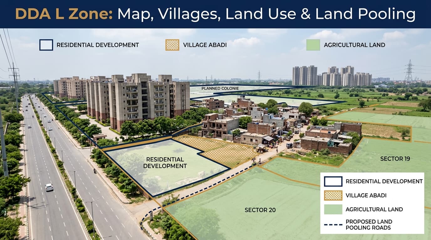
Delhi L Zone Village List, Map, & Plots
The planning process in Delhi involves the zoning of land for various uses along with the development and expansion of urban infrastructure. Officially, Delhi L Zone is known as Zone L or West Delhi-III, which encompasses a vast expanse of western and southwestern Delhi. This zone contains villages, settled areas, agriculture lands, planned as well as unplanned land, infrastructure corridors and land pool areas. From the buyer’s perspective, just looking at “L Zone” in any property advertisement is insufficient for ascertaining what construction activities are permissible in the respective parcel, whether someone is looking for L Zone property, plots in L Zone, or L Zone residential plots. Zone L is one of the planning zones in Delhi Master Plan 2047 context and has been formally named West Delhi-III. As per the zonal planning documentation published by DDA, it has been referred to as a huge planning zone which includes villages and a Census Town known as Najafgarh. The extent of land that is covered by the particular Zone L Zonal Development Plan is around 21,933 hectares. There are 58 villages and one Census Town known as Najafgarh recorded within the plan, forming the basis for the L Zone village list and L Zone Delhi map used for planning and property research. The area also includes land where buyers may encounter residential land in L Zone, commercial land in L Zone and DDA L Zone Land Pooling, but these designations should be verified for the specific parcel before any property decision is made. The important point is that Zone L is a planning area, not a single land-use category. Residential, commercial, agricultural, recreational, institutional, transportation and other land-use designations can exist within the same planning zone. The geographical boundaries help explain where this planning area sits within Delhi. According to the zonal development plan, the area is broadly bounded by: North: Delhi-Rohtak railway line East: Existing high-tension transmission line and Zone K, mainly around the Dwarka side South: Boundary of the National Capital Territory of Delhi West: NCT Delhi boundary The planning region encompasses many villages and settlements. Some of the villages that come up when it comes to planning in the region include Najafgarh, which is a major settlement related to the region, along with Chhawla, Ujwa, Qazipur, and Neelwal. The actual relation of a village to locality to sector to property lot is quite significant, since these are different tiers of identification. One of the most important points for property buyers is that the entire planning area does not have one uniform land-use designation. Delhi's planning framework includes multiple broad land-use categories, which can be further divided into specific use zones under the Development Code. Depending on the location, applicable designations can include: Residential land is just one aspect of the wider planning context. The land parcel can belong to a location that belongs to the category of residential, but the actual land parcel can have a different categorization or other restrictions. This is also true for commercial land. Just because a roadfront land parcel or the land parcel that is close to a developed market cannot be categorized as commercial land. Therefore, L Zone residential plots and residential land in L Zone should be checked against the applicable planning documents before assuming that residential development is permitted. Similarly, commercial land in L Zone must be verified through the relevant land-use designation rather than being identified only by its location or surrounding development. Agriculture lands need to be considered separately as agriculture categorization is a different planning concept. Before purchasing land, buyers should verify: Exact Khasra or parcel number Revenue records Applicable village or locality Land-use designation Whether the parcel falls within a sector Whether it is part of a notified planning or development area Applicable development controls Road access and right of way Ownership and title documents The planning framework also includes land set aside for activities that complement the broader urban system. This may include educational institutions and facilities, parks, transportation facilities and other public facilities. This is because any land designated for such activities cannot just be taken to be ordinary residential or commercial land. The specific land-use designations are important in terms of the transactions of the particular properties. The Zonal Development Plan can be regarded as an important link between the Master Plan and the detailed plans at the layout level. The Zonal Development Plan provides the necessary framework for land use, circulation, infrastructure, open spaces and social facilities in the planning area. However, it is not correct to think of the Zonal Development Plan as the approval of the particular property or permission to build on it. The planning process normally starts from the broad Master Plan through the planning zone to the details of the particular plan or property verification. Land Pooling is another planning tool that is distinct from other planning tools under the urban extension system of Delhi. Zone L falls into the category of the planning zones that fall under the DDA Land Pooling Policy. According to the information of the DDA regarding land pooling, there are 105 villages across 6 planning zones, which includes Zone L as well, along with sector-wise maps for pooled land. This distinction is particularly important: Being in Zone L does not automatically mean that a property is part of land pooling. Land pooling needs to be checked separately using the applicable village, sector, pooled-land records and parcel details. The DDA's current reference material provides sector delineation and pooled-land maps for Zone L. The sector-wise material identifies 41 sectors in the land pooling area. DDA also maintains specific maps for individual sectors, including Sector 3. A simplified verification structure is: Village → Land Pooling Applicability → Sector → Pooled Land Status → Khasra/Parcel → Land Use → Development Controls This sequence is more useful than relying on a property advertisement that simply describes a plot as a “DDA-approved L Zone property.” If you are considering a property in this planning area, do not stop at the location shown in an online listing. Check the following: Ownership: Match the seller's ownership documents with the relevant revenue records. Khasra details: Confirm the exact survey/Khasra number of the property. Village: Verify the revenue village and applicable planning records. Planning zone: Confirm that the parcel actually falls within the claimed planning area. Land use: Check the applicable land-use designation for the specific parcel. Land pooling: Establish whether the land falls within the applicable land pooling framework. Sector: If relevant, identify the correct sector and check its pooled-land status. Road access: Verify physical access instead of relying only on a map or advertisement. Development controls: Check the applicable restrictions before assuming construction is permitted. Latest records: Use the latest available DDA plans, notifications and modifications. Professional legal or planning advice can be useful when ownership, inheritance, land-use, pooling or development records are complicated. Several terms used in property marketing can create confusion. “L Zone means residential land.” “Every village in the zone is under land pooling.” “DDA map means construction approval.” “DDA-approved plot means clear title.” “Near a major road means commercial land.” A practical verification process is: Start with the property address or village. Confirm the planning zone. Locate the parcel. Check land use. Check land pooling separately. Check development conditions. This approach helps separate the location of a property from its actual planning and development status. It is the DDA planning area officially known as Zone L or West Delhi-III. It covers a large part of western and southwestern Delhi and includes villages, settlements and different land-use designations. The planning area includes Najafgarh and numerous villages, including Chhawla, Ujwa, Qazipur and Neelwal. The exact planning status of a property depends on its specific location and parcel. No. The planning area contains multiple land-use categories, including residential, agricultural, commercial, institutional, recreational, transportation and utility uses. No. Planning-zone status and land-pooling status are separate. The specific village, sector and parcel must be checked against the applicable land-pooling records. Start with the village and Khasra number, then verify the planning zone, land-use designation, sector and pooled-land status where applicable. Ownership and development permissions should also be checked separately. Zone L is a complicated and expansive planning zone whose location, land use, land pooling, and development status may differ from one plot to another. It is important for someone to know the distinction between a planning zone, village, sector, land use classification, and pooled land in order to make a sound decision concerning land. Both buyers and sellers can use the services of Prooperty.com to investigate a property, but the status of the individual plot should always be checked from the relevant records.What Is Zone L?
Zone L Map and Boundaries
Zone L Villages and Major Localities
Land Use in Zone L
Residential, Commercial and Agricultural Land
Institutional, Recreational, Transportation and Utility Uses
Zonal Development Plan for Zone L
Zone L and Land Pooling
Villages, Sectors and Pooled Land
What Buyers Should Verify
Common Misunderstandings
Not necessarily. The planning area contains multiple land-use categories.
Land pooling applicability must be checked against the relevant policy, notification and records.
A planning map does not automatically provide construction permission. This distinction is also important when reviewing DDA F Zone property information.
Planning status and legal ownership are separate issues.
Road proximity does not by itself establish commercial land use.How to Check Whether a Property Falls in Zone L
Identify the revenue village and locality.
Check the applicable DDA planning map.
Match the Khasra or survey number with the relevant revenue and planning records.
Determine the designation applicable to that particular parcel.
If the property is marketed as a pooled-land opportunity, verify the relevant village, sector and pooled-land records.
Review the applicable plans, notifications and development controls before treating the land as construction-ready.FAQs
What is DDA L Zone?
Which areas are associated with Zone L?
Is all land in Zone L residential?
Is every property in Zone L covered by land pooling?
How can I verify a property?
Conclusion