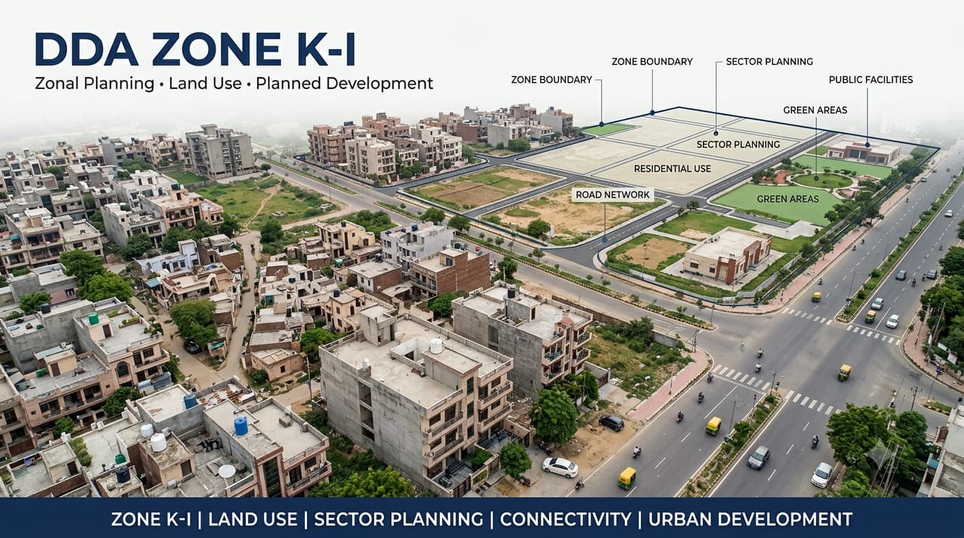
DDA Zone K 1 Land Use & Development Plan
The western planning areas in Delhi comprise various planning zones having different kinds of developmental features and land use zoning systems. One such planning area in western planning zones of Delhi is DDA K1 Zone that has unique geographical boundaries, villages, land use system, and developmental planning system. It becomes necessary for the buyers and sellers of properties to understand the planning area of K1 as the mere knowledge of the name of the planning zone will not reveal the development and land use permissions related to an individual property. The K-I planning zone needs to be studied in terms of its planning maps, villages, land use permissions, and relevant development plans.
What Is DDA K-I Zone?
DDA K-I Zone is one of the planning zones of Delhi and is generally known as West Delhi-II. DDA K I Zone comprises a vast expanse of western Delhi and has a mixture of developed as well as undeveloped areas, villages, etc. The planning characteristic of DDA K I Zone cannot be judged merely by the name of the locality. Various portions of the same zone might have different planning zones while roads, greenery, public amenities, and future infrastructural plans can affect the development pattern. Therefore, it becomes imperative to understand the DDA K-I Planning Map when studying the area.
DDA K1 Zone Delhi Map
The DDA K1 Zone Delhi Map helps users understand the geographical extent and planning structure of the zone. A map can provide a broader view of villages, settlements, roads, land-use areas and other planning elements, while more detailed planning documents can be used for examining individual areas.
When reviewing a DDA K1 Zone Map, it is useful to focus on the following elements:
DDA K1 Zone Areas and Villages
The K-I planning zone is made up of developed areas and villages, as well as other development areas. It does not mean that if there is a village in a planning zone, the whole village must have a similar classification of land use and development. Villages can have various uses of land, such as developed land, agricultural land, roads, public lands, and others. Hence, the Zone K1 Delhi must be analyzed on both levels.
When researching a village or locality in K-I, the following information can help establish its planning context:
Name of the village or locality
Planning zone
Exact location
Applicable land-use designation
Layout or sector information, where available
Road and infrastructure reservations
Development status
Applicable planning modifications
This approach is particularly useful for buyers searching for property in areas where village boundaries and urban development overlap.
Land Use in DDA in Zone
Land use is one of the most important aspects of understanding any DDA planning zone. K-I is not restricted to one type of land use. Different portions of the zone can contain residential, commercial, institutional, recreational, transportation, utility and other designated areas.
The important point is that DDA K1 Zone is a planning area, not a single land-use category. A property buyer should therefore avoid assuming that a plot is residential simply because it is located inside K-I.
DDA K-I Development Plan
Development plan is used in planning K-I in the context of the connection between land uses, transport, public facilities, open space and other infrastructures. The development plan offers a much wider view about the intended use of various portions of the zone and the connection of the existing areas to any planned development. In property research, the development plan will be useful in answering issues like whether the area under investigation is part of any planned development structure and what the land uses are near the property.
DDA K1 Zone Map and Khasra Number
A planning map provides zone-level information, while a K1 Zone Delhi Map Khasra Number search involves connecting the planning location with a specific parcel or revenue record. This distinction is important because a large planning map may contain many properties, villages and land parcels with different planning statuses.
For a more detailed property review, the following information can be compared:
A khasra number should not be considered proof of a particular land use. It helps identify a parcel, but the planning designation and legal ownership must be established through the relevant records.
Residential and Commercial Land
Both residential and commercial uses can fit into the planning system, but the development of the area in which they sit cannot alone determine whether the use is permissible. This point becomes especially significant when potential buyers look at plots or developments with labels like “residential plot,” “commercial plot” or “DDA approved land.” Whether the property is being compared with areas such as DDA L Zone or DDA F Zone, the label should be contrasted against the relevant planning documentation, applicable land-use designation and title deeds before assuming that a particular use is permitted.
K-I Zone, Land Pooling and Development
Land pooling is a separate planning mechanism and should not be confused with the general geographical definition of a planning zone. A property being located within K-I does not automatically establish that it is covered by land pooling.
For property research, the following distinction is useful:
Planning zone: Defines the geographical planning area.
Land-use designation: Identifies the planned use of a particular area.
Land pooling: Applies to specific areas under the relevant framework.
Khasra/parcel: Identifies the individual land parcel.
Development permission: Depends on applicable rules and approvals.
The DDA land pooling policy should therefore be checked separately when a property is being assessed for land-pooling applicability.
K-I and Wider Delhi Planning Framework
As K-I is one of the zones within the larger framework of urban planning of Delhi, its development cannot be studied in isolation from all these aspects. In fact, the inter-connection of the zone under consideration with the adjoining planning zones, transport network, availability of public facilities, and future development plans can affect the overall development of the area. On the other hand, while studying future planning plans for the zone, it should not be taken in isolation from the existing position of the property. However, for wider planning study, the Delhi Master Plan 2047 can be studied independently from the particular planning scheme of the property.
How to Check a Property in DDA K-I Zone
Property verification should begin with the exact parcel rather than stopping at the zone name. A practical process is to identify the property location, establish the relevant village or locality, locate the parcel and then compare it with the applicable planning documents.
Identify the exact location
Start with the complete property location, including village, locality, road and other available identifying information. This helps establish which portion of K-I contains the property.
Check the K-I planning map
Use the applicable K-I planning map to understand the property's location within the zone and identify surrounding planning elements.
Verify land use
Check the applicable land-use designation instead of assuming that the property follows the use of nearby buildings or businesses.
Match the property with parcel information
Where available, compare the planning location with the plot number, khasra number or other parcel identification details.
Check development and infrastructure plans
Look for planned roads, transport corridors, public facilities, green areas and other infrastructure that may affect the parcel.
Review applicable permissions
Land-use designation alone does not establish construction permission. Applicable development controls and approvals should be checked separately.
Verify ownership
Planning status and ownership are separate issues. Title and ownership documents should therefore be examined independently.
Common Mistakes About DDA K-I Zone
Assuming K-I is entirely residential
K-I contains multiple land-use categories. The zone name does not establish the land use of an individual property.
Treating a DDA K1 Zone Map as property approval
A planning map provides geographical and planning information but does not automatically approve construction on a specific parcel.
Assuming every village has the same planning status
Villages can contain different land uses, built-up areas, roads, agricultural land and other planning designations.
Using nearby development as proof of land use
Existing shops, offices or residential buildings around a property do not automatically establish the official designation of the parcel being considered.
Confusing land pooling with the planning zone
Land pooling has its own applicability and requirements. It should be checked separately rather than inferred from the K-I zone name.
Relying on an outdated map
Planning information can change through modifications and updated planning documents. The applicable version should be checked during property due diligence.
FAQs
What is DDA K1 Zone?
DDA K1 Zone, also known as K-I or West Delhi-II, is a designated planning zone of Delhi with its own planning boundaries, land-use framework, development areas and infrastructure planning.
What does the DDA K1 Zone Map show?
The DDA K1 Zone Map helps show the geographical extent of K-I and can provide information about villages, land uses, roads, public facilities, green areas and other planning elements.
Is all land in K-I residential?
No. K-I can contain multiple land-use categories, including residential, commercial, institutional, recreational, transportation, utility and other uses.
Can a K-I property be verified using a khasra number?
A khasra number can help identify a specific parcel, but it does not by itself establish land use, ownership or development permission. It should be compared with the relevant planning and legal records.
Does being in K-I mean a property is under land pooling?
No. Planning-zone location and land-pooling applicability are separate matters. The specific property and relevant land-pooling records need to be checked.
Does the K-I development plan provide construction permission?
No. A development plan provides planning information. Construction depends on the applicable development controls, permissions and approvals for the particular property.
Conclusion
DDA K1 Zone is a big planning area with a wide variety of land use and development pattern. The maps and plans of K1 Zone will enable the user to gain an understanding of the connections between villages, residential and commercial zones, public facilities, roadways, and all other planned uses. For people buying properties, the first and foremost thing to do is to go beyond the name "DDA Zone" and look into the details of the specific location of the property, its land use, parcel detail, development plans and ownership details.