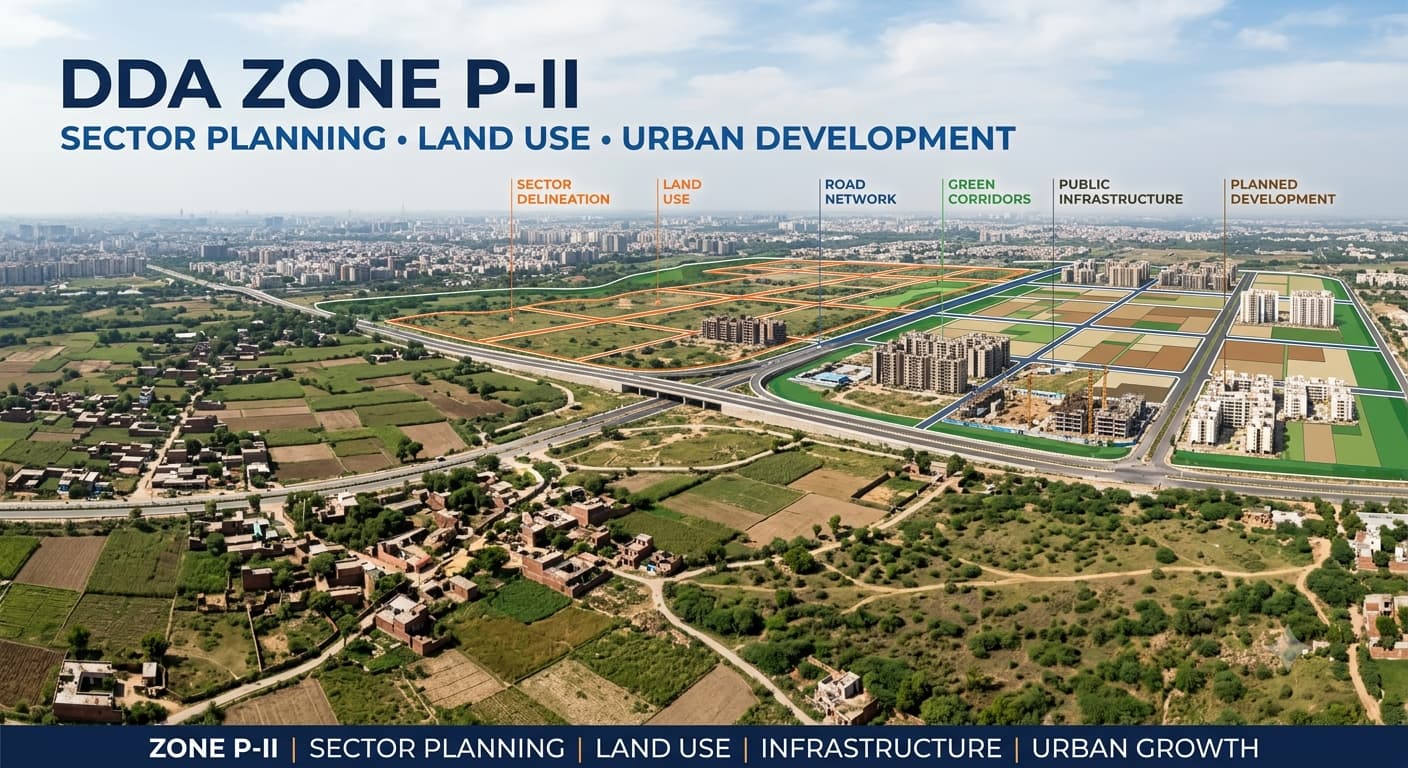
DDA Zone P 2 Areas, Villages & Land Pooling
DDA Zone P-2 is an essential planning zone in Delhi where there is a need to know about land use, village demarcations, sector planning, and development control provisions together. This zone is a combination of pre-existing settlements, villages, development areas, corridors, and plots which might come under different planning provisions. Any person studying properties in this region of Delhi would find it useful to know the planning zone, but just by mentioning the planning zone, the legal purpose and development status of the property cannot be identified.
What Is DDA Zone P 2?
DDA Zone P-II is one of the planning zones in Delhi according to the development planning scheme of the city. Similar to other DDA planning zones, this planning zone is useful for organizing the land use plan, infrastructure requirements, development areas and future urban growth of the area geographically.
Depending upon its precise location, a property in the P-II area can come under varied categories of land-use zoning depending upon the planning documents. There can be a variety of uses such as residential, commercial, institutional, recreational, transportation, utility and others in the overall planning area. Hence, it becomes necessary to carry out property level verification rather than just depending upon the locality name or even the property advertisement.
Delhi Zone Location
The Zone P2 Delhi location is usually identified in accordance with the planning zone scheme adopted by the DDA and not by any particular locality. The Delhi Zone P2 location includes an entire area comprising several villages and planned sectors, and hence its precise location will have to be determined in accordance with the particular zone boundaries and planning maps. This approach is also relevant when understanding planning areas such as L Zone Delhi and DDA F Zone Delhi, where the zone represents a broader planning area rather than a single locality. It is necessary to differentiate between the zone location and the locations of the individual sectors and villages when identifying a property.
DDA P2 Zone Map
The DDA P2 Zone Map is the more extensive geographical setting for the planning zone. It can assist the user in understanding how the zone relates to villages, sectors, roads, land-use zones, and other planning features. But a general map must never be taken as definitive proof that a certain piece of land is allowed for construction and use. Although the Zone P2 Delhi map and Delhi Zone P2 map may serve as good guides for identifying the location of an area, it is necessary that the identification of the property goes from the general zone map to more detailed information.
How to Read a P-II Planning Map
Identify the P-II zone boundary first.
Locate the relevant village, locality or settlement.
Check whether the property falls inside a planned sector.
Match the property with the available khasra, parcel or survey information.
Check the applicable land-use designation.
Review development controls before treating the property as development-ready.
Areas and Villages in P-II
P-II contains different types of settlements and planning areas, including villages and areas incorporated into the wider urban development framework. The presence of a village within the planning zone does not automatically mean that every parcel within that village has the same land-use designation or development potential.
Land Use in Zone P-II
P2 Zone Map Sector Wise
The utility of the P2 Zone Map Sector Wise Approach will increase in case of research on land which is located in the sector under planning. Sector limits could serve as a more refined planning guideline than the larger P-II Zone limit, especially in cases where land pooling and sector level infrastructure planning is considered. However, sector level validation must be related to the particular property. Sector number is not an indicator of the ownership, title, or eligibility for construction or development of that land.
DDA Zone P-II and Land Pooling
Land pooling is an important part of planning in selected areas of P-II, but the terms P-II Zone and land pooling area should not be treated as interchangeable. Land pooling applies to specifically identified areas and sectors under the applicable framework. A property being located in P-II does not by itself prove that it is part of the land-pooling process.
Key Land-Pooling Checks
Delhi land pooling should be considered when the property falls within an applicable notified land-pooling area.
Check whether the relevant parcel is included in the applicable land-pooling records.
Verify the sector and participating land status rather than relying on a broker or listing description.
Check the required contiguous pooled-land threshold where applicable.
Confirm infrastructure and development conditions before treating pooled land as immediately developable.
Zone P2 Delhi Price
The phrase Zone P2 Delhi price is often used by property buyers and investors while searching for land or plots in the area. However, P-II itself does not establish a single property price. Values can differ substantially depending on the exact locality, road access, plot size, land-use designation, title status, development status and surrounding infrastructure.
Factors That Can Affect Property Value
P2 Zone Delhi Master Plan
The P2 Zone Delhi Master Plan search would normally be concerned with the placement of the P-II Planning zone in relation to Delhi’s overall planning framework. The Zone Level Plan offers a more refined planning framework as compared to just the knowledge that the property lies in North Delhi or in a specific locality. One could explain the planning framework by first looking at the city level framework, followed by the planning zone, sector/village and then the parcel. This would avoid treating an extensive planning framework as a property approval framework.
DDA master plan 2047 — broader future planning framework to consider alongside applicable planning documents.
DDA ZDP — helps understand planning and land-use proposals at the zonal level.
Sector plan — provides more detailed information for applicable planned sectors.
Layout plan — can provide further detail for specific planned developments.
Common Mistakes About DDA Zone P-II
Treating P-II as a single land-use category
P-II is a planning zone, not one uniform land-use designation. Different parcels can have different planning uses and restrictions.
Assuming every P-II property is part of land pooling
Land pooling applies to specified areas and sectors. The zone name alone does not establish participation or eligibility.
Using a general map as property approval
A broad DDA map can help locate an area, but it does not replace parcel-level verification.
Comparing prices only by zone
A P-II location does not produce one standard market rate. Property characteristics and legal and planning status can make prices substantially different.
Ignoring the khasra number
For land-related transactions, the khasra or equivalent parcel identification can be critical for matching the property with revenue and planning records.
Related DDA Planning Topics
FAQs
What is DDA Zone P-II?
DDA Zone P-II is a designated planning zone in Delhi containing different villages, settlements, planned areas and land-use categories. Its planning status should be understood through the applicable zonal and sector-level records.
Where is Zone P-II in Delhi?
Zone P-II covers a broad planning area rather than one single locality. The exact location of a property within P-II should be checked using its village, sector and parcel details.
Is every P-II property covered by land pooling?
No. Land pooling applies to specifically identified areas and sectors. A property must be checked against the applicable land-pooling records.
Does the P2 Zone Delhi map prove that a plot is approved?
No. A planning map can help identify the location and planning framework, but it does not by itself establish ownership, title, permitted construction or development eligibility.
How is Zone P2 Delhi price determined?
There is no single price for the entire P-II zone. Property value can vary according to location, land use, access, plot characteristics, title status, development status and surrounding infrastructure.
Why is the khasra number important in P-II?
A khasra number can help identify the specific parcel in revenue and planning records. It is especially useful when verifying land-related property claims.
Conclusion
The DDA Zone P-II should be seen as a planning model comprising various villages and sectors within it, rather than one homogeneous property market. The maps may help define the wider context, whereas the details of land use and development will become apparent from the sector data and parcel records. If the property studies are to be done in P-II zone, the right way to go about it would be to first identify the exact parcel in question, along with its land use, the status of the sector, land pooling situation and any other relevant documentation.