DDA Zone K 2 Dwarka Area Land
DDA Zone K II is one of the most significant planning zones in southwest Delhi and has a strong connection to the planning and development of Dwarka. Zone K 2 has its own specific urban fabric that includes residential sectors, commercial zones, institutions, recreation areas, transport facilities and other services. Knowledge of the planning framework of K II can prove very useful to any researcher exploring property, land use and development opportunities in or around Dwarka. The DDA Zone K2 Delhi Planning Framework should be understood in terms of its boundary, land use pattern, sector structure, roads, facilities and development plans. The fact that a property lies in Dwarka or in K II alone does not determine the land use or development possibilities for the same.
What Is DDA Zone K-II?
K-II is one of the planning zones of Delhi and is often considered to be associated with Dwarka. While other planning zones in the city consist of a combination of old villages along with new land on the periphery, K-II is more defined by urban planning and is a product of the organization of sectors and sector-based development. The planning of K-II consists of sectors of housing, commercial areas, institutions, recreational areas, roads, transport, and utilities. This leads to an organized pattern of urban development but not all lands in the zone have the same land use designation.
DDA Zone K2 Map
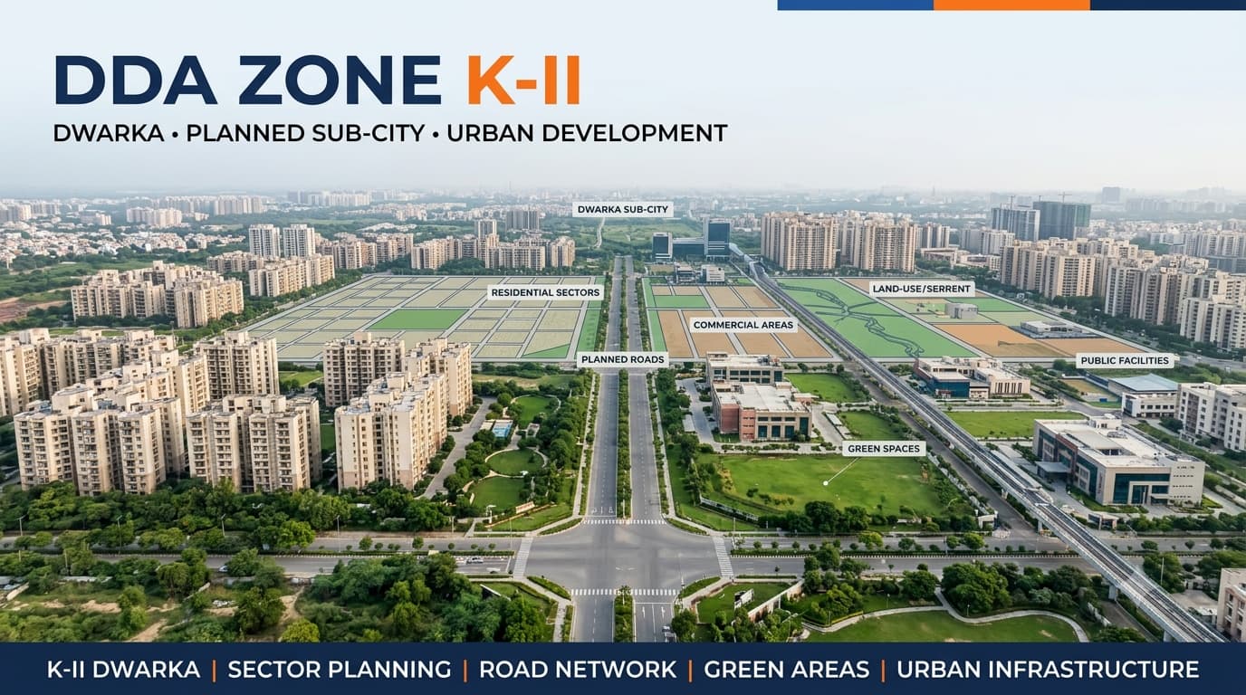
The DDA Zone K2 Map provides a visual understanding of the planning area and its relationship with different sectors, roads, facilities and land-use zones. For users researching Dwarka, the map can help establish where the K-II planning area begins and ends and how different parts of the zone are organized.
A map can be particularly useful for understanding:
Areas and Sector Structure in K-II
The planning framework of Dwarka follows the sector approach, hence sector identification becomes significant while carrying out an analysis on a piece of property. It is to be noted that each sector can comprise elements such as pockets for residential purposes, commercial spaces, institutions, parks, roads, and other planned usage forms.
The following information can help establish the planning context of a K-II property:
Dwarka sector and sub-area
Exact plot or property location
Applicable land-use designation
Layout Plan
Road and circulation network
Nearby public facilities
Recreational and green areas
Utility infrastructure
Development controls
Relevant planning modifications
This approach is useful whether someone is researching an apartment, commercial property, institutional parcel or another type of land within the K-II planning area.
Land Use in DDA Zone K-II
The use of land in K-II is in accordance with the planned urban nature of Dwarka. The residential use is one of the main elements of the area, yet other elements such as commercial, institutional, recreational, transportation and utilities uses are also present in the planning framework. However, the presence of certain use on the ground cannot be viewed as an evidence of the land-use zoning. For instance, the functioning of an office as an office does not prove that the land-use zoning of the area is commercial.
Understanding this distinction is particularly important when researching property advertised as residential or commercial in K-II.
Residential Areas in K-II
Residential development is one of the core components of the Dwarka planning structure. The sectoral approach provides residential plots with a network of roads, parks, commercial, institutional sites, and other urban infrastructure facilities. It is particularly crucial when assessing the property which is advertised under the general terms like “property in Dwarka,” “property in K-II” or “residential plot in Dwarka.” The marketing definition should be compared to the relevant planning information.
Commercial and Institutional Sites
Commercial and institutional uses play an important role in the planning structure of K-II. Commercial sites provide marketplaces, office buildings, and other economic facilities, while institutional sites provide educational, health care, governmental, and community facilities. The same planning principle applies when assessing areas such as Delhi L Zone and Delhi F Zone, where surrounding commercial or institutional activity does not automatically determine the designated use of an individual property. Proximity to a commercial centre does not necessarily mean that the property is commercial; similarly, proximity to an institution does not mean that the property is intended for institutional use. Property assessment should, therefore, differentiate between surrounding activities and the official designation of the site.
Transportation, Roads and Infrastructure
Transport is a critical component of K-II development planning since the planned urban form for Dwarka is based on major roads, internal roads, and transport links. Transport and road infrastructures determine accessibility but can have an impact at the level of individual property when there are reservation, widening, or any other requirements. Utility infrastructure is also a vital element of the planning structure since water supply, drainage, sewerage, electricity, and waste management infrastructures ensure that the urban area functions, but may be located in separate pieces of land or be subject to planning issues.
DDA Zone K-II Phase 2
The term DDA Zone K2 Phase 2 may cause some misunderstanding because property advertisements and searches may refer to phases of development planning in ways different from those used in official documentation. The buyer should understand that he is dealing with the particular sector, development area, or planning document rather than a certain unified land use area referred to as "Phase 2." When buying property by the phase or project, one must check the location on the relevant DDA map and Layout Plan.
DDA Zone K-II and Development Planning
This is because K-II’s framework combines all these elements into an integrated plan, and hence the larger region can be treated as a cohesive development pattern rather than individual plots of land. This explains why DDA Zone K2 Delhi is useful in getting information about the planning context, but only as a prelude to further verification of property-specific facts.
K-II and Other DDA Planning Zones
K-II is one element in the overall planning framework of Delhi, and it must be evaluated in comparison to other planning zones as per the planning parameters of each zone. For instance, K-I, P-I and P-II are some planning zones which have different geographic context and development patterns from K-II. Readers interested in exploring the overall planning framework of DDA would find the following related links useful:
These different zones should not be treated as interchangeable because each has its own planning boundaries, development structure and applicable documents.
How to Check Property Land Use in K-II
Property verification should begin with the exact location and then move through the relevant planning documents. The sector name can help locate the property, but the actual parcel and land-use designation need to be established separately.
Identify the exact sector
Start with the Dwarka sector, sub-area, road and other available location details. This helps narrow down the relevant part of the K-II planning area.
Locate the property
Identify the exact plot, building or parcel rather than relying only on the locality or sector name.
Check the land-use designation
Review the applicable land-use plan to determine whether the property falls within a residential, commercial, institutional, recreational, transportation, utility or other designated area.
Review the Layout Plan
Where available, compare the property with the relevant Layout Plan to understand roads, plots, facilities and other local planning elements.
Check infrastructure and reservations
Review roads, transport corridors, utility areas and other infrastructure that could affect the property.
Verify development controls
Land-use identification does not automatically establish what can be constructed. Applicable development controls and permissions must be checked separately.
Verify ownership and title
Planning information and legal ownership are different matters. Ownership and title records should therefore be examined independently.
K-II and Land Pooling
Land pooling needs to be assessed in terms of its own separate considerations independent of the planning zone status of K-II. The presence of DDA zone does not automatically imply that all properties within such a zone are automatically considered for land pooling. In case of those properties that may require consideration of land pooling, the relevant areas, sectors, eligibility and property details need to be evaluated independently. The geographical representation of zones does not constitute land pooling of any property.
For reference:
Planning zone: Broad geographical planning division.
ZDP: Zone-level planning and development framework.
Land pooling: Separate framework applicable to specified areas.
Sector: Local planning unit that may be relevant to development.
Property parcel: Exact land requiring individual verification.
The Delhi land pooling policy should therefore be examined separately whenever land pooling is part of the property assessment.
K-II and Future Delhi Planning
Proposals for future planning should be clearly differentiated from the planning document that currently controls the particular property. An infrastructure project, a potential change in land use or any development idea should reflect a potential direction of urban planning, but it should not necessarily mean that it is already the property right. From a broad perspective of research, Delhi master plan 2047 could be taken as future planning, while actual planning documents should be taken as the basis of current property rights.
FAQs
What is DDA Zone K-II?
DDA Zone K-II is a designated planning zone associated with Dwarka in Delhi. It has a planned sector structure containing residential, commercial, institutional, recreational, transportation and utility uses.
What does the DDA Zone K2 Map show?
The DDA Zone K2 Map helps users understand the geographical extent of the zone and the relationship between sectors, roads, land uses, facilities and other planned elements.
Is all property in K-II residential?
No. K-II contains multiple land-use categories. A property's exact designation needs to be verified from the applicable planning information.
What is DDA Zone K2 Phase 2?
The term DDA Zone K2 Phase 2 may be used in property searches or descriptions, but the exact area or sector being referred to should be established from the location and applicable planning documents.
Does being in Dwarka prove commercial or residential land use?
No. Dwarka contains different land-use categories. The exact property and its applicable designation should be checked separately.
Can a DDA K-II map confirm construction permission?
No. A map provides planning information. Construction depends on applicable development controls, permissions and approvals for the particular property.
Conclusion
DDA Zone K-II is an integral element of Delhi’s urban planning system and has strong associations with the development of Dwarka. The sectoral organization of DDA Zone K-II encompasses residential zones, commercial hubs, institutions, recreation facilities, transport facilities, and various other utilities under the ambit of urban planning. But for any analysis of property in K-II zone, the name of the zone or sector alone must not be seen as the answer. The property location, classification of the land use, Layout Plan, amenities, development control and property ownership information needs to be analyzed individually.