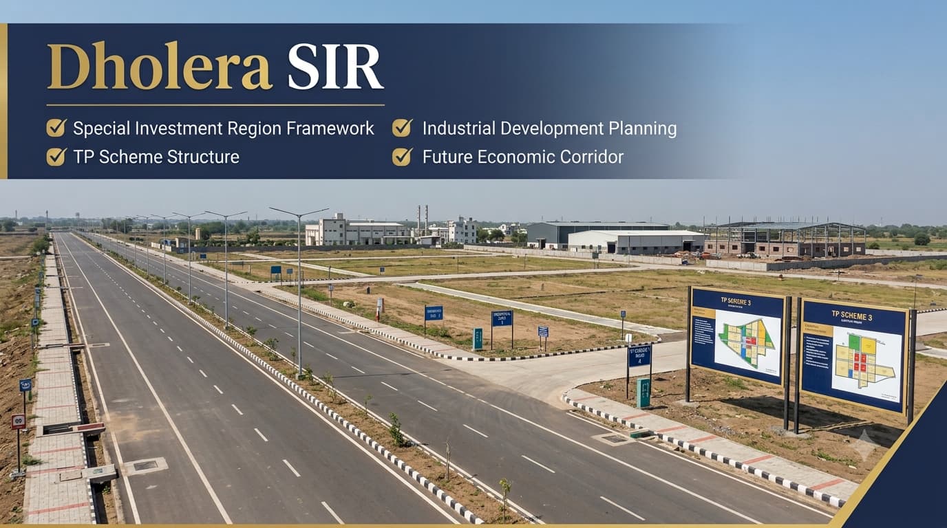
Dholera Special Investment Region (SIR)
Dholera SIR stands for Dholera Special Investment Region in India which is the first planned green field smart industrial city. This city lies approximately 100 kilometers south-west of Ahmedabad in Gujarat. The special investment region is spread over nearly 920 square kilometers and is being developed as a part of the Delhi-Mumbai Industrial Corridor (DMIC) as an industrial, logistics, commercial and urban development zone. The special investment region will comprise several sectors like industrial zone, residential zone, commercial zone and logistics zone.
The special investment region has been planned taking into consideration smart infrastructure, utility integration, renewable energy programs and sustainable urban development. The special investment region consists of advanced transportation infrastructure, underground utility network, digital infrastructure and industrial ecosystem for future manufacturing activities. As development takes place in phases, it is recommended that investors, businesses and homebuyers should check the current status of the development project.
Dholera SIR is often perceived as equivalent to Dholera Smart City, although these two terms actually refer to different concepts. The Special Investment Region refers to the broader notified planning area defined by state law, while DSIR refers to the primary urban project within that area. It is crucial to understand the difference between these two concepts since various planning policies, TP Schemes, village demarcations, infrastructure routes, and land use planning are all done on the level of SIRs. Those readers new to the topic will find useful information and interested in planning maps and land organization will have to consult the Dholera TP Schemes.
What Is Dholera SIR?
Dholera SIR full form is Dholera Special Investment Region is a government planned investment region which is being developed to encourage orderly economic development through a combination of infrastructure, industrial planning and sustainable urbanisation. Unlike a typical industrial estate or township which focuses on one particular development area, the Dholera Special Investment Region comprises various elements of development such as an industrial district, commercial centers, logistics infrastructure, institutional buildings, residential neighborhoods, transport routes and environmental areas which all come under one planning jurisdiction.
The idea of the Special Investment Region is not limited to traditional city planning since it is based on the combination of economic development with the development of infrastructure and regional planning goals. The development of infrastructure and land use, transportation system, utilities, environmental protection and institutional buildings all comes together for greater efficiency and less problems related to future development.
Dholera SIR At A Glance
What makes Dholera SIR special compared to traditional development projects is that unlike conventional projects, it is created as an integrated regional planning framework and not a separate city. The organisational structure of Dholera SIR ensures integrated planning and implementation of decisions related to infrastructures, transport systems, utility services, environmental management, industrial developments, and public services. It is also for this reason that many large-scale projects including the Ahmedabad-Dholera Expressway, Dholera International Airport, and Town Planning Schemes have been developed as part of the development strategy of SIR rather than being separate projects.
Administration Framework of SIR
The organisational structure of Dholera SIR has been created in such a way that ensures that planning, infrastructure developments, implementation of policies and management of the region are carried out in an integrated manner. Since the Special Investment Region consists of a large geographical expanse along with different planning components, various authorities are responsible for each of these components rather than a single organisation taking care of all of these issues. Through the governance process, the land-use planning, infrastructure, industrial developments, environmental management, and public service functions can be coordinated during different phases of development processes.
The Dholera Special Investment Region Development Authority (DSIRDA) serves as the main planning body that prepares the plans for development, manages the land use planning, approves the planning frameworks and ensures regional growth. The infrastructure creation is done by the Dholera Industrial City Development Limited (DICDL), whereas the government bodies ensure policy decisions, creation of infrastructure and industrial corridors. These institutions, when put together, create a governance structure that helps in facilitating planning and not development in a haphazard manner.
Administrative Framework
Dholera SIR Vs Smart City
Readers looking for a detailed overview of the city's infrastructure, development vision, and planned urban ecosystem can continue focuses specifically on the city's development rather than the broader administrative region.
Planning Framework Of Dholera SIR
Dholera SIR’s planning strategy is built on the model of systematic regional development rather than the traditional model of project-based development. Before allocating lands for various industries, residential neighborhoods, business districts or public institutions, a complete framework for planning has been devised that will include details regarding the layout of transport corridors, utility systems, environmentally protected regions, public amenities and potential sites for expansion. This will help ensure the coordination between development and infrastructure, along with efficient land utilization throughout the region.
A very important element of this framework of planning includes Town Planning (TP) Schemes that arrange lands in planned sectors, allocate lands for public infrastructure and provide the legal framework for future development. They facilitate the implementation of infrastructures while providing improved accessibilities and balanced urban development. Rather than explaining the TP Schemes in detail, readers can go through the Dholera Master Plan & TP Schemes to find out about the planning hierarchy and land use organization through the Final Plot system.
Core Planning Components
Development Components Within Dholera SIR
The development of the Dholera SIR has been made in such a manner that it acts like an integrated regional ecosystem where different development components work together rather than being individual projects. In the plan for SIR, industrial districts, commercial centers, logistics hubs, residential zones, transport networks, institutional buildings, and environmental zones have been included under a coordinated development scheme. Such planning will not only help different sectors work together in harmony but will also help in the development of infrastructure in accordance with future needs and not because of unplanned developments. This will allow systematic land allocation through the master plan so that a well-organized environment can be created to facilitate economic and other activities.
An important feature of the Dholera SIR has been its phase-wise development strategy. Rather than trying to develop the entire notified area in one go, the infrastructure development of the region has been done first in some planned regions and then moving on to others. Such an approach helps in making the best use of resources and makes the infrastructure systems operational in stages, facilitating regional development without any compromise on the planning norms.
Major Development Components
Role Of Villages In Dholera SIR
The geographical basis of Dholera SIR comprises 22 officially notified villages which form the planning area for the Special Investment Region. These villages do not represent just an administrative demarcation but provide the basis for the identification of lands, Town Planning Schemes, infrastructure planning, and further development work. Rather than using conventional sector numbers as seen in most cities, the planning in Dholera focuses more on villages, TP schemes, final plot numbers, and land use zones. This structure should be kept in mind by anyone interested in understanding planning maps and documents in this region.
Villages are also very important for the organization of the infrastructure corridors, transport network, utilities, and further urban development. As the development moves ahead, these areas keep getting incorporated in the planning structure. The readers who would like to understand more about each of these villages and their significance in the planning of the Special Investment Region may proceed to the Dholera Villages Guide.
Regional Planning Profile
Infrastructure Supporting Dholera SIR
The success of the Dholera SIR over the long run will depend on the infrastructure network that connects industries, businesses, services, and future urban development. The region has been planned not only through individual projects but as a result of a synergy between expressways, internal roads, utility corridors, airport infrastructure, and industrial logistics infrastructure. While such projects increase the accessibility of the region, they also serve as the backbone of physical facilities necessary for sustainable development. In other words, infrastructure planning becomes an integral part of the Special Investment Region as opposed to post-urbanization activity.
There are several infrastructure projects that relate to the Dholera SIR: Ahmedabad-Dholera Expressway, the prospective Dholera International Airport, internal transportation corridors, and underground utilities. All these projects add to connectivity, logistic efficiency, and future industrial development in the region. If you are interested in transport infrastructure, you should consider using the Dholera Connectivity Guide and Ahmedabad-Dholera Expressway. In case you want to assess long-term growth potential in the region,Investment in Dholera and Dholera Plot might be helpful.
Major Infrastructure Supporting The Region
Frequently Asked Questions
Is it safe to invest in Dholera SIR?
Investing in Dholera SIR can be considered after proper legal verification. Buyers should confirm land ownership, approvals, zoning regulations, project status, and investment risks before making any financial commitment.
What is the full form of Dholera SIR?
Dholera SIR stands for Dholera Special Investment Region, a planned greenfield industrial and smart city development in Gujarat designed to support manufacturing, infrastructure, logistics, and urban growth.
Who is the owner of Dholera?
Dholera is not owned by a single individual or private company. The region is planned and developed under government authorities through designated agencies responsible for its implementation and administration.
What is the current status of Dholera?
Dholera is being developed in phases with ongoing infrastructure, industrial, transportation, and urban development projects. Progress varies across different sectors, making it important to check the latest official updates.
What is the Dholera City plot price?
Plot prices vary depending on location, plot size, infrastructure availability, land use, and market demand. Buyers should compare different options and verify legal approvals before investing.
What is the SIR Dholera full form?
The full form of SIR is Special Investment Region, referring to a planned area developed to promote industrial growth, infrastructure development, commercial activities, and planned urban expansion.
Where is Dholera city located?
Dholera is located in the Ahmedabad district of Gujarat, approximately 100 kilometres southwest of Ahmedabad, with connectivity through highways, expressways, and planned transportation infrastructure.
How far is Dholera from Ahmedabad?
Dholera is located around 100 km from Ahmedabad. Improved road infrastructure, including the Ahmedabad-Dholera Expressway, has significantly reduced travel time between the two locations.
What are the Smart City project details?
The project includes industrial zones, residential areas, commercial districts, logistics hubs, transportation infrastructure, renewable energy initiatives, and smart urban facilities developed in multiple phases.
What is Dholera SIR on Wikipedia?
Dholera SIR is commonly described as India's first planned greenfield smart industrial city in Gujarat, developed as part of the Delhi-Mumbai Industrial Corridor with modern infrastructure and industrial planning.
What is Dholera SIR Projects Pvt Ltd?
This refers to a private company name associated with Dholera-related developments. Buyers should independently verify any company's legal approvals, project credentials, and documentation before investing.
Conclusion
Dholera SIR lays down the administrative, planning, and regulatory framework for one of the most ambitious regional development initiatives in India. Unlike an individual infrastructure project or urban township, it sets up a framework which encompasses land-use planning, transport systems, industrial infrastructure, utilities, environment, phased urbanization and much more in an integrated development framework. Such an integrated development framework allows the different infrastructure projects and planning initiatives to move ahead in an organized manner and facilitate regional development in the notified Special Investment Region.
Getting familiar with SIR helps us understand the link between different elements of the region. All the Smart City, Town Planning Schemes, official villages, transport systems, industrial development happen within the broad framework of development that is laid down for the Special Investment Region. At Prooperty.com, we aim to make such interconnected concepts easier to understand via well-researched and informative. Dholera Master Plan & TP Schemes, Dholera Connectivity, Dholera Investment and Dholera Villages, each information catered to a unique search intent but complements.