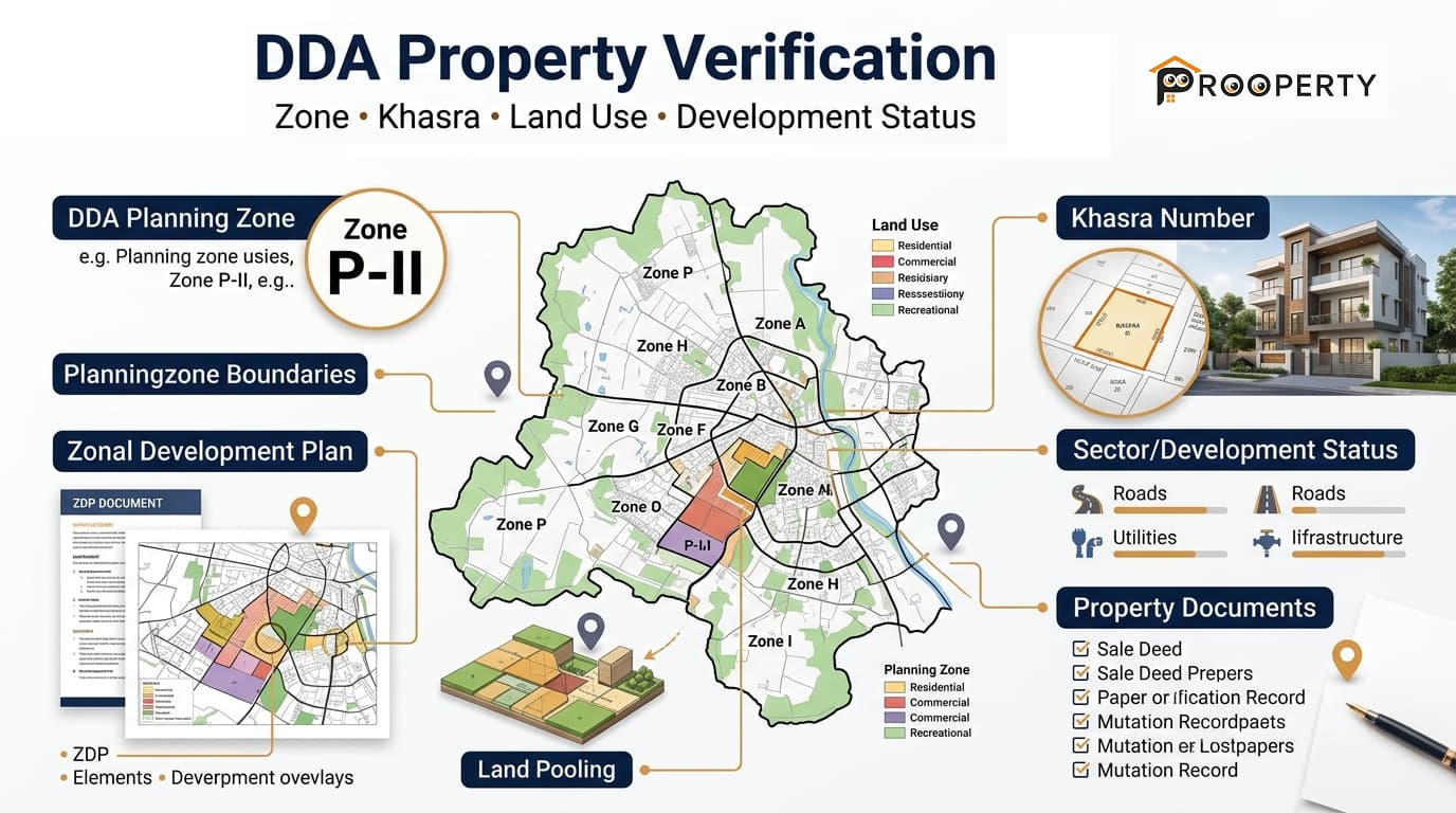
Purchasing or selling property in Delhi is not simply a matter of looking at the property's address or the statements contained in the advertisement. DDA property verification assists the buyer in determining the position of a property within the planning hierarchy of Delhi, its land use classification, whether it is a property included in any development plan or any land pooling scheme, and the relationship of the planning of that property to its legal documents. While a property may be labeled as a residential plot, commercial plot, DDA approved property or land pooling property, these labels must be corroborated from the planning and property documentation. The safest way is to verify the property on an incremental basis, beginning with the precise location of the property and then proceeding to the other information. Delhi Property Verification refers to the verification of planning and development information pertaining to a certain property in the city of Delhi. It becomes very significant in cases where the property belongs to or near areas covered under DDA planning zone, land pooling area, planned development and future development. The verification process needs to establish the property rather than simply the locality name. In some cases, depending on the nature of the property, it may be necessary to verify the planning zone, village/locality, Khasra no., land use, ZDP, layout or sector plan and land pooling. A practical verification process can be divided into several layers: These checks should be considered together. A match at one level does not automatically confirm the property at every other level. The first planning-level step is to identify the DDA planning zone in which the property is located. Delhi is divided into planning zones, and each zone has its own planning framework and development information. For example, Prooperty.com has already covered several important planning areas through its zone-specific articles, including: These pages can help explain the planning context of the respective zones, but the exact property still needs to be matched with the relevant planning and property records. Once the planning zone is identified, it is necessary to determine the exact village or locality to which the property belongs. This is important because a planning zone may have several villages or other planning areas within it. The locality name used in the advertising for a property may not be enough to determine the revenue plot number. Khasra Number is one of the crucial numbers in ascertaining information on a land parcel. This number enables one to link the particular land parcel with the revenue record and should not be mistaken for a property listing number, plot number, or sector number. When verifying a property, verify if the information on Khasra number provided by the seller or property listing relates to the property and revenue records. In case there is property listing according to the plot number without any parcel number, further verification becomes necessary. After that, comes the land use determination. The Delhi planning scheme has various land use categories, namely, residential, commercial, industrial, institutional, recreational, transport and others. Land use designation of a plot does not necessarily depend on the land use of its surroundings. For instance, a plot close to a commercial market is not necessarily a commercial one. The same way, land surrounded by residential plots is not necessarily residential in its land use. Zonal Development Plan provides additional information about the planning of a particular zone. According to DDA, ZDP is a link between the master plan and layout plans. Social infrastructure, parks, open spaces, circulation and designated land use zones are included in the ZDP. If you want to check the land use of your plot, ZDP will assist you in doing so. Please find out further information at Prooperty.com's DDA Zonal Development Plan article. Land pooling should be checked separately when the property falls within an applicable land-pooling area. DDA's current land-pooling information states that the policy applies to urban extension areas comprising villages in specified planning zones, and DDA provides related maps and planning resources for these areas. For property verification, check: Whether the property falls within an applicable land-pooling area The relevant planning zone The village in which the land is situated The applicable sector Whether the relevant parcel appears in available pooled-land mapping Whether the information needs verification against revenue records The current development or participation status applicable to the sector The key to the issue of property verification lies in the distinction between planned and approved property. The property may be in a DDA-planning zone but not necessarily belong to DDA. It may be in a planned land use zone but not have all the necessary approvals for its development. Therefore: DDA planning zone ≠ DDA ownership DDA land-use designation ≠ automatic development permission Land-pooling area ≠ completed development Property listing claim ≠ official approval If a seller or broker describes a property as "DDA approved," ask exactly what approval is being referred to and request the supporting documentation. The claim should be checked against the applicable planning, development, title and revenue records. The exact documents required can vary according to the property and transaction, but a buyer should generally examine the documents relevant to both planning and ownership. Useful records may include: Sale deed and title documents Previous ownership documents where relevant Revenue records Khasra or parcel details Property or plot identification details Applicable land-use information Planning-zone information Zonal Development Plan Layout or sector plan, where applicable Land-pooling records, where applicable Development or approval-related documents Applicable permissions or NOCs The purpose is to compare the physical property, planning records and legal documents rather than relying on any single document. A simple verification workflow can make the process easier. Start with the complete address rather than only the locality or project name. Determine the relevant village, locality and administrative identification associated with the property. Find the planning zone and review the relevant planning information. Match the Khasra or other parcel identification with the property documents. Determine the applicable land-use designation and compare it with the proposed use of the property. Check the relevant ZDP to understand the area's planning framework, land use and proposed infrastructure. Where applicable, compare the property with the relevant layout, sector delineation or detailed planning information. If the property falls within an applicable land-pooling area, check the relevant sector and pooled-land information. The planning information should be considered alongside the ownership and revenue documents. Before making a purchase decision, verify any claims about approvals, development, infrastructure, land pooling or permitted use through the relevant records. Before proceeding with a property, check the following: Exact property address Village/locality DDA planning zone Khasra or parcel number Applicable land use Zonal Development Plan Layout or sector plan Land-pooling status, where applicable Development status Title and revenue documents If one of these important layers cannot be established, additional verification may be necessary before relying on the property's advertised status. DDA property verification is the process of checking a property's planning zone, parcel identification, land use, applicable development plans, land-pooling status where relevant, development information and ownership documents. Start with the exact property location and identify the applicable planning zone using relevant DDA planning maps and records. The zone should then be matched with the property's village, parcel and planning information. The Khasra number should be checked against the applicable revenue and property records and matched with the exact parcel. It should not be assumed to be the same as a plot or sector number. No. A planning-zone designation identifies the property's position within the planning framework. It does not by itself establish ownership, approval or development permission. Identify the exact property or parcel and compare it with the applicable land-use plan and Zonal Development Plan. The property's surrounding development should not be used as the sole basis for determining its land use. First identify the property, village, planning zone and sector. Then review the applicable DDA land-pooling maps and records and compare the information with the relevant revenue records. No. Planning or approval-related terminology should not be treated as proof that DDA owns the property. Ownership needs to be established through the applicable title and revenue records. The relevant documents can vary, but property buyers should examine title and revenue records together with applicable planning-zone, land-use, ZDP, layout, land-pooling and development information. No. A planning map is primarily a planning reference. Ownership should be established through the applicable legal and revenue documents. The process of DDA property verification must be considered as the process relating to the individual property rather than just searching for the name of the zone and/or an approval mark. It begins with locating the exact property site, determining the village and planning zone, verifying the Khasra number, determining land use, considering the Zonal Development Plan and layout/sector of the property, and checking whether the land is pooling or not, when required. Most importantly, information on planning must be kept separate from ownership. The fact that the property lies in a planning area, pooling area, or specific DDA zone doesn’t mean that the property is approved or developed.DDA Property Verification
What Is DDA Property Verification?
What Should You Verify Before Buying a DDA-Related Property?
How to Check the DDA Planning Zone of a Property
How to Check the Village or Locality
How to Check the Khasra Number
How to Check DDA Land Use
How to Check DDA Zonal Development Plan
How to Check DDA Land Pooling Status
DDA Approved Plot vs DDA Planned Land
Documents to Check During Property Verification
Step-by-Step Property Verification Process
Step 1: Collect the Exact Property Address
Step 2: Identify the Village or Locality
Step 3: Identify the DDA Planning Zone
Step 4: Confirm the Khasra or Parcel Details
Step 5: Check Land Use
Step 6: Review the Zonal Development Plan
Step 7: Check the Layout or Sector Plan
Step 8: Check Land-Pooling Status
Step 9: Compare Planning Records With Revenue and Title Records
Step 10: Verify Development and Approval Claims
DDA Property Verification: Quick Checklist
FAQs
What is DDA property verification?
How can I check the DDA zone of a property?
How can I verify a DDA property Khasra number?
Does being in a DDA zone mean a property is DDA approved?
How do I check DDA land use for a property?
How can I check DDA land-pooling status?
Is DDA-approved land the same as DDA-owned land?
What documents should I check before buying property in a DDA planning area?
Can a DDA planning map prove property ownership?
Conclusion